Toggle navigation
LMEC Home
Exhibitions
Georeferencing
Tools for Teachers
Collections
My Favorites
Sign Up / Log In
Search
Search the map portal
Map Collection
Map Collection
Map Sets
Search
Search
Search for
Search In
All Fields
Creator
Title
Subject
Place
Search All Digital Collections
Advanced Search
8176 Results
My Search
Start Over
More Like
commonwealth:kk91fq60v
Remove constraint More Like: commonwealth:kk91fq60v
Date facet yearly ssim
1800
to
1849
Remove constraint Date facet yearly ssim: <span class='from'>1800</span> to <span class='to'>1849</span>
Filter your Search
Place
North and Central America
4,921
United States
3,605
Suffolk (county)
1,026
Boston
999
Europe
963
Canada
429
France
269
Massachusetts
249
more
Place
»
Topic
Boston (Mass.)--Maps
574
United States--Maps
270
Real property--Massachusetts--Boston--Maps
174
Massachusetts--Maps
160
Landowners--Massachusetts--Boston--Maps
132
North America--Maps--Early works to 1800
103
New England--Maps
99
Europe--Maps
78
more
Topic
»
Date
Date range begin
–
Date range end
Current results range from
1482
to
2023
View distribution
Creator
United States. Hydrographic Office
357
O.H. Bailey & Co
148
Des Barres, Joseph F. W. (Joseph Frederick Wallet), 1722-1824
124
United States. Post Office Dept
120
Ptolemy, 2nd cent
100
Walling, Henry Francis, 1825-1888
94
Jefferys, Thomas, -1771
85
Geological Survey (U.S.)
82
more
Creator
»
Format
Maps/Atlases
8,117
Manuscripts
215
Prints
51
Books
36
Objects/Artifacts
10
Drawings/Illustrations
8
Posters
4
Georeferenced
Yes
869
No
7,307
Collection
Norman B. Leventhal Map Center Collection
8,168
Boston and New England Maps
2,185
Urban Maps
1,925
Maritime Charts and Atlases
754
American Revolutionary War-Era Maps
624
Boston Redevelopment Authority Collection
86
Mapping Boston Collection
6
Richard H. Brown Revolutionary War Map Collection at Mount Vernon
5
more
Collection
»
Available to use
No known restrictions
8,021
Creative Commons license
58
Search Constraints
Sort by title
relevance
title
date (asc)
date (desc)
Number of results to display per page
50 per page
10
per page
20
per page
50
per page
100
per page
View results as:
grid view
map view
Search Results
901.
Buzzards Bay
902.
[Buzzards Bay and Vineyard Sound]
903.
[Buzzards Bay and Vineyard Sound]
904.
Buzzards Bay, Mass
905.
Caerte van de Rivier Demerary van ouds Immenary, geleger op Suyd Americaes Noordkust, op de Noorder Breedte van 6 Gr. 40
906.
Caerte van de voornaemste reysen ende ontdeckingen door de Hollanders gedaen, alsook vande landen, plaetsen ende factoriën in...
907.
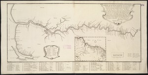
La Calabria citeriore
908.
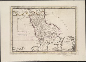
Calabria citra olim magna Graecia
909.
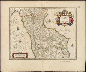
La Calabria ulteriore
910.
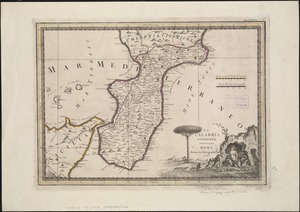
Calabria ultra olim altera magnae Graeciae pars
911.
Caldera Bay, west end of the island of Mindanao, Sooloo Sea
912.
Calvert's map of the lake region in New Hampshire, U.S.A.
913.
Camarines Sur : (western part)
914.
Cambriae typus
915.
Cambridge City, Ind : 1871
916.
Camp at Framingham : Second Brigade Mass. Vol. Militia, July 21st to 25th 1885
917.
Camp at Framingham : First Brigade Mass. Vol. Militia June 9th to 13th 1885
918.
Camp Wetmore, R.I. brigade militia, July 7th to 11th, 1885, Oakland Beach
919.
Campagna di Roma : olim Latium : patrimonio di S. Pietro : et Sabina
920.
La Campagna di Roma il Patrimonio di S. Pietro e la Sabina
921.
Campaign maps : Army of the Potomac : Map no. 3. White House to Harrison's Landing
922.
Campaign maps : Army of the Potomac : Map no. 2. Williamsburg to White House
923.
Campbell's revised guide map of St. Louis
924.
Campus High School urban renewal area Mass. r-129 : property map
925.
Canada and Nova Scotia
926.
Canada and Nova Scotia
927.
Canada orientale nell' America Settentrionale
928.
Le Canada, ou Nouvelle France, &c : ce qui est le plus advance vers le Septentrion est tiré de diverses relations des Anglois,...
929.
Le Canada, ou Nouvelle France, la Floride, la Virginie, Pensilvanie, Caroline, Nouvelle Angleterre et Nouvelle Yorck, l'Isle de...
930.
Canadian Rockies showing main line of Canadian Pacific Ry. with branch lines & steamship connections
931.
The Canadian west
932.
Canal du Cap-Cod : plan général du tracé du canal
933.
Canary Islands, Tenerife, Santa Cruz
934.
Cannonade at Pass Krug, 3d. October 1758
935.
Canobie Lake Park, Salem N.H.
936.
A canoeist's guide to New England's rivers
937.
Canso Harbor
938.
Cantium vernacule Kent
939.
Der Canton-Strom, meistens nach den englischen aufnahmen von 1840-1857
940.
Cape Ann and the North Shore : a map displaying the hardy maritime development of these historic parts
941.
Cape Blowmedown : Cape Split ; Spencers Island and the entrance to Mines Bason ; Ile Haut and Cape Chegnecto
942.
Cape Cod and the islands
943.
Cape Cod Bay
944.
Cape Cod Bay, Massachusetts
945.
Cape Fear River, with the counties adjacent, and the towns of Brunswick and Wilmington, against which Lord Cornwallis, detached...
946.
Cape May City and vicinity, New Jersey
947.
Cape Poge bearing S 52°E, distant 2 miles : Sandy Point bearing W S W distant four miles ; Gay Head bearing N E 1/4 E and...
948.
Cape Prospect bearing N: by E: distant 10 1/2 miles : Cape Sambro ... ; The high lands of Haspotagoen ... ; The Ovens ... ;...
949.
The Cape Verd Islands : laid down from the remarks and observations of experienced navigators
950.
The Cape Verd Islands, laid down from the remarks and observations of experienced navigators
‹ Prev
Next ›
1
2
…
15
16
17
18
19
20
21
22
23
…
163
164

![[Buzzards Bay and Vineyard Sound]](https://bpldcassets.blob.core.windows.net/derivatives/images/commonwealth:7h149w47r/image_thumbnail_300.jpg)
![[Buzzards Bay and Vineyard Sound]](https://bpldcassets.blob.core.windows.net/derivatives/images/commonwealth:7h149z564/image_thumbnail_300.jpg)