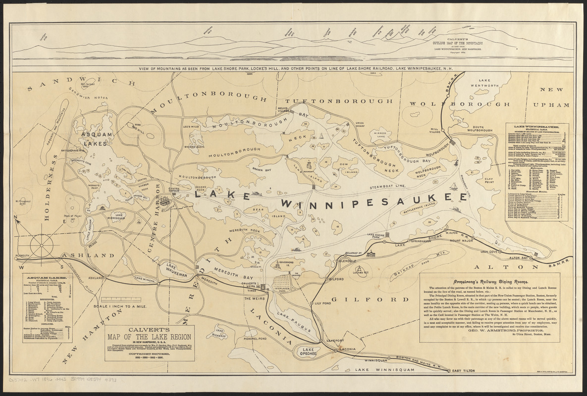
Calvert's map of the lake region in New Hampshire, U.S.A.
Item Information
- Title:
- Calvert's map of the lake region in New Hampshire, U.S.A.
- Title (alt.):
-
Map of the lake region in New Hampshire
- Publisher:
- M.H. Calvert & Co.
- Surveyor:
- Crocker, William P.
- Printer:
- Geo. H. Walker & Co.
- Name on Item:
-
prepared from original surveys made by Wm. P. Crocker, Esq., civil engineer in 1858
- Date:
-
1896
- Format:
-
Maps/Atlases
- Location:
-
Boston Public Library
Norman B. Leventhal Map & Education Center - Collection (local):
-
Norman B. Leventhal Map & Education Center Collection
- Subjects:
-
Railroads--New Hampshire--Maps
Steamboat lines--New Hampshire--Maps
Winnipesaukee, Lake (N.H.)--Maps
- Places:
-
New HampshireWinnipesaukee, Lake
- Extent:
- 1 map : color ; 45 x 72 cm
- Terms of Use:
-
No known copyright restrictions.
No known restrictions on use.
- Publisher:
-
Weirs, N.H. :
M.H. Calvert & Co., of Calvert's Weirs Times and Tourists' Gazette
- Scale:
-
Scale 1:63,360
- Language:
-
English
- Notes:
-
Shows roads, railroads and steamboat lines.
Relief shown by spot heights.
Oriented with north toward the upper left.
Includes profile view of the mountains as seen from Lake Winnepesaukee; advertisement for Armstrong's Railway dining rooms; and statistical tables, references and steamboat route distances for Lake Winnepesaukee and Asquam Lakes.
- Notes (citation):
-
Cobb, David A. New Hampshire maps to 1900, 500
- Identifier:
-
06_01_016145
- Call #:
-
G3742.W7 1896 .M43
- Barcode:
-
39999085944393