Toggle navigation
LMEC Home
Exhibitions
Georeferencing
Tools for Teachers
Collections
My Favorites
Sign Up / Log In
Search
Search the map portal
Map Collection
Map Collection
Map Sets
Search
Search
Search for
Search In
All Fields
Creator
Title
Subject
Place
Search All Digital Collections
Advanced Search
8592 Results
My Search
Start Over
More Like
commonwealth:js956m40g
Remove constraint More Like: commonwealth:js956m40g
Filter your Search
Place
North and Central America
5,847
United States
4,769
Massachusetts
2,052
Europe
1,360
Suffolk (county)
1,034
Boston
1,007
Canada
448
Asia
423
more
Place
»
Topic
Boston (Mass.)--Maps
577
United States--Maps
273
Real property--Massachusetts--Boston--Maps
174
Massachusetts--Maps
160
Landowners--Massachusetts--Boston--Maps
132
North America--Maps--Early works to 1800
104
New England--Maps
99
Europe--Maps
79
more
Topic
»
Date
Date range begin
–
Date range end
Current results range from
1482
to
2023
View distribution
Creator
United States. Hydrographic Office
594
O.H. Bailey & Co
148
Des Barres, Joseph F. W. (Joseph Frederick Wallet), 1722-1824
123
United States. Post Office Dept
120
Ptolemy, 2nd cent
100
Walling, Henry Francis, 1825-1888
94
Geological Survey (U.S.)
86
Jefferys, Thomas, -1771
85
more
Creator
»
Format
Maps/Atlases
8,533
Manuscripts
215
Prints
56
Books
36
Objects/Artifacts
10
Drawings/Illustrations
8
Posters
4
Georeferenced
Yes
869
No
7,723
Collection
Norman B. Leventhal Map & Education Center Collection
8,571
Boston and New England Maps
2,204
Urban Maps
1,936
Maritime Charts and Atlases
1,081
American Revolutionary War-Era Maps
617
Boston Redevelopment Authority Collection
87
Mapping Boston Collection
21
Sidney R. Knafel Map Collection at Phillips Academy
19
more
Collection
»
Available to use
No known restrictions
8,409
Creative Commons license
69
Search Constraints
Sort by relevance
relevance
title
date (asc)
date (desc)
Number of results to display per page
20 per page
10
per page
20
per page
50
per page
100
per page
View results as:
grid view
map view
Search Results
121.
Orbis terrarum typus de integro multis in locis emendatus
122.
Orbis typus uniuersalis iuxta hydrographorum traditionem
123.
Orbis typus uniuersalis iuxta hydrographorum traditionem
124.
Oval map of the world
125.
A plat of all the world : projected according to the truest rules being far more exact than either the plain-card or the maps...
126.
Quam hic vides orbis imagine[m] lector ca[n]dide ea[m] ut posteriore[m] ita & eme[n]datiorem ijs que hactenus...
127.
Secunda etas mundi = Secunda etas mũdi
128.
Secunda etas mundi = Secunda etas mũdi
129.
Tipus orbis uniuersalis iuxta Ptolomei cosmographi traditionem et Americi Vespucii alior[um]que
130.
Tipus orbis uniuersalis iuxta Ptolomei cosmographi traditionem et Americi Vespucii alior[um]que
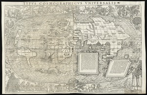
131.
Typus cosmographicus uniuersalis
132.
Typus cosmographicus uniuersalis
133.
Uniuersalior cogniti orbis tabula ex recentibus confecta obseruationibus
134.
Uniuersi orbis seu terreni globi in plano effigies
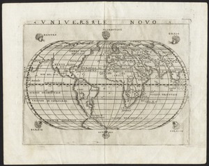
135.
Universale novo
136.
Universalis de terrao orarium ex vera recen [...] traditione
137.
World map
138.
World map
139.
World map
140.
The 100th anniversary map of Abraham Lincoln's visit to Massachusetts, September 11-23, 1848
‹ Prev
Next ›
1
2
3
4
5
6
7
8
9
10
11
…
429
430


![Quam hic vides orbis imagine[m] lector ca[n]dide ea[m] ut posteriore[m] ita & eme[n]datiorem ijs que hactenus circu[m]ferebantur esse America sarmatiaq[ue] ac India testantur ... lemei expectato vale](https://bpldcassets.blob.core.windows.net/derivatives/images/commonwealth:3f463b69r/image_thumbnail_300.jpg)


![Tipus orbis uniuersalis iuxta Ptolomei cosmographi traditionem et Americi Vespucii alior[um]que](https://bpldcassets.blob.core.windows.net/derivatives/images/commonwealth:j3860806q/image_thumbnail_300.jpg)
![Tipus orbis uniuersalis iuxta Ptolomei cosmographi traditionem et Americi Vespucii alior[um]que](https://bpldcassets.blob.core.windows.net/derivatives/images/commonwealth:3f463b65n/image_thumbnail_300.jpg)


![Universalis de terrao orarium ex vera recen [...] traditione](https://bpldcassets.blob.core.windows.net/derivatives/images/commonwealth:hq37vv39x/image_thumbnail_300.jpg)


