Toggle navigation
LMEC Home
Exhibitions
Georeferencing
Tools for Teachers
Collections
My Favorites
Sign Up / Log In
Search
Search the map portal
Map Collection
Map Collection
Map Sets
Search
Search
Search for
Search In
All Fields
Creator
Title
Subject
Place
Search All Digital Collections
Advanced Search
8699 Results
My Search
Start Over
More Like
commonwealth:ht250b713
Remove constraint More Like: commonwealth:ht250b713
Filter your Search
Place
North and Central America
5,925
United States
4,843
Massachusetts
2,078
Europe
1,396
Suffolk (county)
1,045
Boston
1,018
Canada
449
Asia
437
more
Place
»
Topic
Boston (Mass.)--Maps
586
United States--Maps
282
Real property--Massachusetts--Boston--Maps
175
Massachusetts--Maps
162
Landowners--Massachusetts--Boston--Maps
133
North America--Maps--Early works to 1800
103
New England--Maps
102
Europe--Maps
79
more
Topic
»
Date
Date range begin
–
Date range end
Current results range from
1482
to
2023
View distribution
Creator
United States. Hydrographic Office
595
O.H. Bailey & Co
148
Des Barres, Joseph F. W. (Joseph Frederick Wallet), 1722-1824
123
United States. Post Office Dept
120
Ptolemy, 2nd cent
100
Walling, Henry Francis, 1825-1888
94
Geological Survey (U.S.)
86
Jefferys, Thomas, -1771
85
more
Creator
»
Format
Maps/Atlases
8,639
Manuscripts
215
Prints
56
Books
36
Objects/Artifacts
11
Drawings/Illustrations
8
Posters
5
Georeferenced
Yes
869
No
7,830
Collection
Norman B. Leventhal Map & Education Center Collection
8,693
Boston and New England Maps
2,232
Urban Maps
2,023
Maritime Charts and Atlases
1,083
American Revolutionary War-Era Maps
615
Boston Redevelopment Authority Collection
87
MacLean Collection Map Library
6
Available to use
No known restrictions
8,551
Creative Commons license
47
Search Constraints
Sort by relevance
relevance
title
date (asc)
date (desc)
Number of results to display per page
20 per page
10
per page
20
per page
50
per page
100
per page
View results as:
grid view
map view
Search Results
1.
Die aufnahmen der Engländer, Franzosen und Russen in hinter-Asien bis zum jahre 1858
2.
Map of Korea
3.
Map of Korea and Manchuria
4.
Standard Russo-Japanese war map July 1904
5.
Japan, the target : a pictorial Jap-map
6.
Asia, Japan and Korea with the surrounding seas and the adjacent coastal region of China : from the latest information
7.
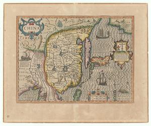
China
8.
Haejwa do
9.
Yeojido
10.
Transportation map of Manchoukuo
11.
China, divided into it's great provinces according to the best authorities
12.
The coasts of the Hwang Hai or Yellow Sea and Gulf of Pechili : compiled from the latest information
13.
Land utilization in Korea
14.
Chart of the coast of China and of the Japan islands : including the Marianes and part of the Philippines
15.
Geological and topographical maps of oil lands of Japan
16.
Insularum Japonicarum : tabulae geographicae secundum opus = Nippon jo tsi ro tei sen tsu
17.
Japan and its relation to the territory bordering on the Pacific Ocean
18.
Japan, south coast of Nipon, Kii Channel to Owasi Bay : from Brit. surveys in 1874 ; republication of Brit. Admty. chart no. 951
19.
Japanese fishing, areas and seasons
20.
[Map of Japan]
‹ Prev
Next ›
1
2
3
4
5
…
434
435


![[Map of Japan]](https://bpldcassets.blob.core.windows.net/derivatives/images/commonwealth:794083229/image_thumbnail_300.jpg)