Map of Korea
Item Information
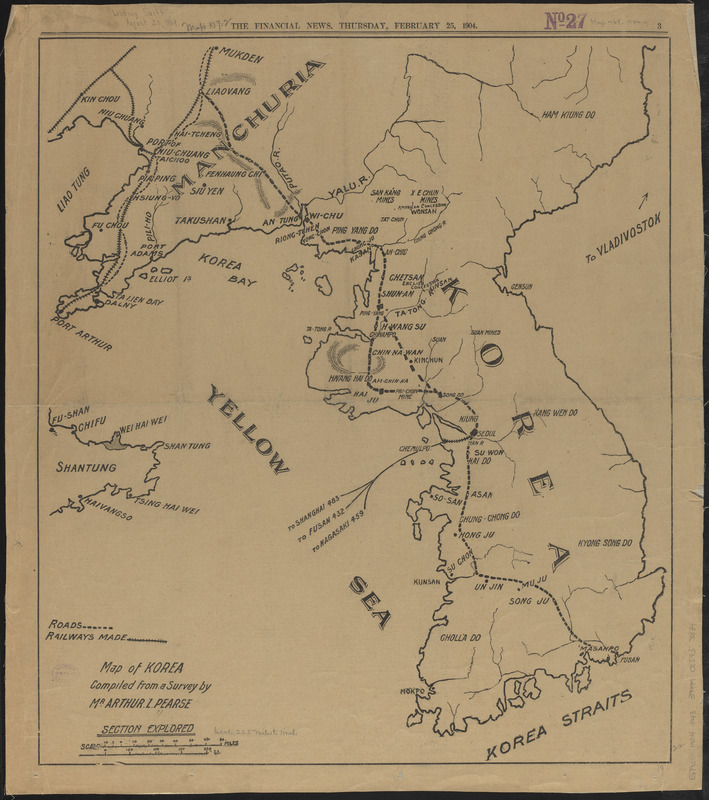
- Title:
- Map of Korea
- Cartographer:
- Pearse, Arthur L.
- Name on Item:
-
compiled from a survey by Mr. Arthur L. Pearse
- Date:
-
1904
- Format:
-
Maps/Atlases
- Location:
-
Boston Public Library
Norman B. Leventhal Map & Education Center - Collection (local):
-
Norman B. Leventhal Map & Education Center Collection
- Subjects:
-
Korea--Maps
Manchuria (China)--Maps
- Places:
-
North Korea
South Korea
ChinaManchuria (area)
- Extent:
- 1 map ; 56 x 49 cm
- Terms of Use:
-
No known copyright restrictions.
No known restrictions on use.
- Publisher:
-
[London] :
Financial News
- Scale:
-
Scale approximately 1:1,400,000
- Language:
-
English
- Notes:
-
Shows major roads and railroads in Korea and part of Manchuria.
Page 3 from the Financial News, Thursday, February 25, 1904.
Text on verso.
- Identifier:
-
06_01_015242
- Call #:
-
G7900 1904 .P43
- Barcode:
-
39999085933834


