Toggle navigation
LMEC Home
Exhibitions
Georeferencing
Tools for Teachers
Collections
My Favorites
Sign Up / Log In
Search
Search the map portal
Map Collection
Map Collection
Map Sets
Search
Search
Search for
Search In
All Fields
Creator
Title
Subject
Place
Search All Digital Collections
Advanced Search
8936 Results
My Search
Start Over
More Like
commonwealth:ht250316k
Remove constraint More Like: commonwealth:ht250316k
Filter your Search
Place
North and Central America
6,167
United States
5,083
Massachusetts
2,166
Europe
1,396
Suffolk (county)
1,282
Boston
1,255
Canada
449
Asia
438
more
Place
»
Topic
Boston (Mass.)--Maps
752
United States--Maps
282
City planning--Massachusetts--Boston--Maps
221
Real property--Massachusetts--Boston--Maps
207
Massachusetts--Maps
166
Landowners--Massachusetts--Boston--Maps
146
Urban renewal--Massachusetts--Boston--Maps
138
New England--Maps
104
more
Topic
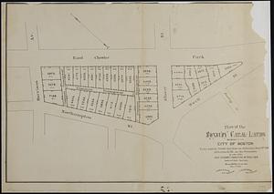
»
Date
Date range begin
–
Date range end
Current results range from
1482
to
2023
View distribution
Creator
United States. Hydrographic Office
595
Boston Redevelopment Authority
224
O.H. Bailey & Co
148
Des Barres, Joseph F. W. (Joseph Frederick Wallet), 1722-1824
124
United States. Post Office Dept
120
Ptolemy, 2nd cent
100
Walling, Henry Francis, 1825-1888
94
Geological Survey (U.S.)
87
more
Creator
»
Format
Maps/Atlases
8,875
Manuscripts
215
Prints
56
Books
36
Objects/Artifacts
10
Drawings/Illustrations
9
Posters
5
Georeferenced
Yes
885
No
8,051
Collection
Norman B. Leventhal Map & Education Center Collection
8,725
Boston and New England Maps
2,425
Urban Maps
2,207
Maritime Charts and Atlases
1,083
American Revolutionary War-Era Maps
642
Boston Redevelopment Authority Collection
257
Mapping Boston Collection
21
Massachusetts Real Estate Atlases
16
more
Collection
»
Available to use
No known restrictions
8,731
Creative Commons license
71
Search Constraints
Sort by relevance
relevance
title
date (asc)
date (desc)
Number of results to display per page
20 per page
10
per page
20
per page
50
per page
100
per page
View results as:
grid view
map view
Search Results
61.
Atlas of the city of Boston, volume five, Dorchester Mass. : from actual surveys and official plans
62.
Atlas of the county of Suffolk, Massachusetts : vol. 2nd late city of Roxbury, now wards 13-14 and 15, city of Boston
63.
Copies of plans of various parts of Brookline and Roxbury
64.
Illustrative site plan : Washington Park urban renewal area, Massachusetts R-24
65.
Map of the town of Roxbury : surveyed by order of the town authorities
66.
Map of the town of Roxbury
67.
Parcel 22
68.
Plan of house lots in Boston belonging to Otis H. Weed
69.
Plan of land in Roxbury belonging to the heirs of Alfred Evans
70.
Plan of the Roxbury Canal lands belonging to the city of Boston to be sold by public auction on Saturday May 19th 1883 at 3...
71.
A plan of the salt marsh and upland in Roxbury, lying the east side of the Mill Creek
72.
Topographical map of Cedar Square, Roxbury
73.
Views of the area around Dudley Station in Roxbury
74.
Washington Street corridor : South Cove to Forest Hills
75.
Woodland Cemetery in Dorchester and Roxbury main entrance on Walk-Hill Street : five miles from Boylston market, direct route...
76.
Annexation map
77.
Atlas of the city of Boston : Boston proper : from actual surveys and official plans
78.
Atlas of the city of Boston : Boston proper and Back Bay : from actual surveys and official plans
79.
Atlas of the city of Boston : Boston proper and Back Bay : from actual surveys and official plans
80.
Atlas of the city of Boston : Boston proper and Back Bay : from actual surveys and official plans
‹ Prev
Next ›
1
2
3
4
5
6
7
8
…
446
447