Toggle navigation
LMEC Home
Exhibitions
Georeferencing
Tools for Teachers
Collections
My Favorites
Sign Up / Log In
Search
Search the map portal
Map Collection
Map Collection
Map Sets
Search
Search
Search for
Search In
All Fields
Creator
Title
Subject
Place
Search All Digital Collections
Advanced Search
304 Results
My Search
Start Over
More Like
commonwealth:hq37vv88v
Remove constraint More Like: commonwealth:hq37vv88v
Filter your Search
Place
North and Central America
261
United States
248
New England
140
Maine
55
Massachusetts
37
New York
36
New Hampshire
32
Vermont
29
more
Place
»
Topic
New England--Maps
127
Maine--Maps
55
Railroads--New England--Maps
50
New Hampshire--Maps
32
Vermont--Maps
29
New York (State)--Maps
27
Massachusetts--Maps
24
New England--Maps--Early works to 1800
15
more
Topic
»
Date
Date range begin
–
Date range end
Current results range from
1482
to
2015
View distribution
Creator
United States. Post Office Dept
9
Carey, Mathew, 1760-1839
8
Carleton, Osgood, 1742-1816
8
Geological Survey (U.S.)
6
Doolittle, Amos, 1754-1832
5
National Publishing Company (Boston, Mass.)
5
Norman, John, 1748?-1817
5
Ortelius, Abraham, 1527-1598
5
more
Creator
»
Format
Maps/Atlases
304
Manuscripts
4
Books
1
Objects/Artifacts
1
Georeferenced
Yes
32
No
272
Collection
Norman B. Leventhal Map & Education Center Collection
168
Boston and New England Maps
127
Sidney R. Knafel Map Collection at Phillips Academy
87
American Revolutionary War-Era Maps
74
Maps from AAS
25
William L. Clements Library Collection
15
MacLean Collection Map Library
6
David Judkins Weaver Papers
5
more
Collection
»
Available to use
No known restrictions
168
Creative Commons license
3
Search Constraints
Sort by relevance
relevance
title
date (asc)
date (desc)
Number of results to display per page
20 per page
10
per page
20
per page
50
per page
100
per page
View results as:
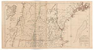
grid view
map view
Search Results
141.
A map of New England, and Nova Scotia; with part of New York, Canada, and New Britain & the adjacent islands of New Found Land...
142.
Map of New England exhibiting the rail road & telegraphic lines now in operation
143.
Map of New England exhibiting the rail road and telegraphic lines now in operation
144.
Map of New England with adjacent portions of New York & Canada
145.
Map of New England with adjacent portions of New York & Canada
146.
Map of New England with adjacent portions of New York & Canada
147.
A Map of that part of America which was the principal seat of war in 1756
148.
Map of the Boston & Maine Railroad, showing its relative position & connection with other railroads
149.
Map of the Boston and Northwestern, Massachusetts Central, and Boston and Poughkeepsie Railroads and their connections
150.
Map of the Boston, Concord, Montreal & White Mountains Railroad and its principal connections
151.
Map of the British and French dominions in North America, drawn by order of the British government in 1755, showing what that...
152.
A map of the coast of New England from Staten Island to the island of Breton
153.
Map of the eastern and middle states
154.
Map of the Eastern Railroad and principal connections
155.
Map of the Eastern Railroad and principal connections
156.
A map of the most inhabited part of New England containing the provinces of Massachusets Bay and New Hampshire with the...
157.
Map of the New England and Middle Atlantic States
158.
A map of the New England states : Maine, New Hampshire, Vermont, Massachusetts, Rhode Island & Connecticut, with the adjacent...
159.
A map of the New England states : Maine, New Hampshire, Vermont, Massachusetts, Rhode Island & Connecticut, with the adjacent...
160.
Map of the New York & Boston Railway, with its connections with other railways
‹ Prev
Next ›
1
2
…
4
5
6
7
8
9
10
11
12
…
15
16