Toggle navigation
LMEC Home
Exhibitions
Georeferencing
Tools for Teachers
Collections
My Favorites
Sign Up / Log In
Search
Search the map portal
Map Collection
Map Collection
Map Sets
Search
Search
Search for
Search In
All Fields
Creator
Title
Subject
Place
Search All Digital Collections
Advanced Search
474 Results
My Search
Start Over
More Like
commonwealth:dn403j96s
Remove constraint More Like: commonwealth:dn403j96s
Filter your Search
Place
North and Central America
394
United States
275
Canada
96
North America
86
New York
24
Pennsylvania
19
Asia
17
Great Lakes Region
16
more
Place
»
Topic
United States--Maps--Early works to 1800
103
Canada--Maps--Early works to 1800
79
North America--Maps--Early works to 1800
77
Great Lakes Region (North America)--Maps--Early works to 1800
17
New England--Maps--Early works to 1800
12
Northeastern States--Maps--Early works to 1800
12
Pennsylvania--Maps--Early works to 1800
12
Great Britain--Colonies--America--Maps--Early works to 1800
9
more
Topic
»
Date
Date range begin
–
Date range end
Current results range from
1618
to
1999
View distribution
Creator
Bellin, Jacques Nicolas, 1703-1772
27
Jefferys, Thomas, -1771
20
Robert Sayer and John Bennett (Firm)
19
Faden, William, 1749-1836
16
Gibson, J. (John), active 1750-1792
14
Carleton, Osgood, 1742-1816
13
Bowles, Carington, 1724-1793
11
Mitchell, John, 1711-1768
11
more
Creator
»
Format
Maps/Atlases
472
Manuscripts
5
Paintings
3
Ephemera
1
Objects/Artifacts
1
Prints
1
Georeferenced
Yes
5
No
469
Collection
American Revolutionary War-Era Maps
406
MacLean Collection Map Library
379
Norman B. Leventhal Map & Education Center Collection
46
New York Public Library Collection
17
Richard H. Brown Revolutionary War Map Collection at Mount Vernon
11
Library and Archives Canada Collection
8
New-York Historical Society Collection
4
Mapping Boston Collection
3
more
Collection
»
Available to use
No known restrictions
47
Creative Commons license
36
Search Constraints
Sort by relevance
relevance
title
date (asc)
date (desc)
Number of results to display per page
20 per page
10
per page
20
per page
50
per page
100
per page
View results as:
grid view
map view
Search Results
81.
The United States of America
82.
The United States of America laid down from the best authorities, agreeable to the peace of 1783
83.
The United States of America laid down from the best authorities agreeable to the peace of 1783
84.
The United States of America with the British possessions of Canada, Nova Scotia, New Brunswick and Newfoundland divided with...
85.
The United States of North America: with the British territories, and those of Spain, according to the treaty, of 1784
86.
Die Vereinigten Staaten von Nord=America : nach der von W.m Faden 1783 : herausgegebenen charte, auf welcher alle im englisch...
87.
Carte de la Nouuelle France, augmentée depuis la derniere, seruant a la navigation faicte en son vray Meridien
88.
La Louisiana, parte settentrionalle, scoperta sotto la protettione di Luigi XIV, Ré di Francia, etc
89.
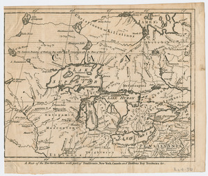
A Map of the five Great Lakes with part of Pensilvania, New York, Canada, and Hudsons Bay Territories &c
90.
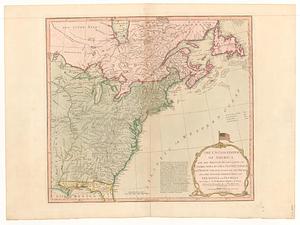
La Pensilvania, la Nuova York, il Jersey Settentrio[na]le : con la parte occidentale del Connecticut, Massachusset-s-bay e...
91.
An accurate map of Canada, with the adjacent countries : exhibiting the late seat of war between the English & French in those...
92.
British colonies in North America : drawn from the best authorities
93.
Carte de Canada, de la Nouvelle Ecosse et de l'Acadie : d'après les originaux Anglais
94.
Carte de la rivire du Cannada, la Terre Nevf, Cape Britton et la cotte de Lacadie
95.
Carte des découvertes qui ont été faites dans la partie occidentale du Canada sur les mémoires de Mr de la Varanderie [Vérendrye]
96.
Carte du Canada ou de la Nouvelle France et des decouvertes qui y ont été faites
97.
Carte d'une partie du Nord Amerique dans la quelle se trouvent les isles et les provinces suivantes : l'Isle de la Terre-Neuve...
98.
Carte generale du Canada ou Nouvelle France
99.
Carte nouvelle contenant la partie d'Amerique la plus septentrionale, ou sont exactement dêcrites les provinces suivantes...
100.
Cours du fleuve St. Laurent : deuxieme feuille : depuis Quebec jusqu'au havre des Papinachouas
‹ Prev
Next ›
1
2
3
4
5
6
7
8
9
…
23
24


![La Pensilvania, la Nuova York, il Jersey Settentrio[na]le](https://bpldcassets.blob.core.windows.net/derivatives/images/commonwealth:z603vq53g/image_thumbnail_300.jpg)


![Carte des découvertes qui ont été faites dans la partie occidentale du Canada sur les mémoires de Mr de la Varanderie [Vérendrye]](https://bpldcassets.blob.core.windows.net/derivatives/images/commonwealth:wp98ck41z/image_thumbnail_300.jpg)