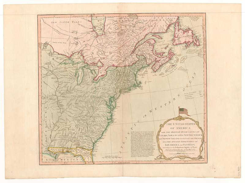
The United States of America with the British possessions of Canada, Nova Scotia, New Brunswick and Newfoundland divided with the French, also the Spanish territories of Louisiana and Florida according to the preliminary articles of peace signed at Versailles the 20.th Jan. 1783
This map is also available in American Revolutionary Geographies Online (ARGO), a collections portal especially built for material relating to the American Revolutionary War Era. Visit ARGO to learn more about this item and explore the historical geography of North America in the late eighteenth century.
Item Information
- Title:
- The United States of America with the British possessions of Canada, Nova Scotia, New Brunswick and Newfoundland divided with the French, also the Spanish territories of Louisiana and Florida according to the preliminary articles of peace signed at Versailles the 20.th Jan. 1783
- Contributor:
- Jefferys, Thomas, -1771
- Date:
-
May 12, 1794
- Format:
-
Maps/Atlases
- Location:
- MacLean Collection Map Library
- Collection (local):
-
MacLean Collection Map Library
- Subjects:
-
United States--Maps--Early works to 1800
- Places:
-
United States
- Extent:
- 1 map ; 460 x 513 mm
- Terms of Use:
-
Public Domain/No known restrictions on use. Contact host institution to download image.
Contact host institution for more information.
- Publisher:
-
London :
Laurie & Whittle, 53 Fleet Street
- Language:
-
English
- Identifier:
-
MC_822
- Call #:
-
822


