Toggle navigation
LMEC Home
Exhibitions
Georeferencing
Tools for Teachers
Collections
My Favorites
Sign Up / Log In
Search
Search the map portal
Map Collection
Map Collection
Map Sets
Search
Search
Search for
Search In
All Fields
Creator
Title
Subject
Place
Search All Digital Collections
Advanced Search
362 Results
My Search
Start Over
More Like
commonwealth:cr56sd027
Remove constraint More Like: commonwealth:cr56sd027
Filter your Search
Place
North and Central America
351
United States
331
Massachusetts
323
Suffolk (county)
50
Boston
48
Rhode Island
31
Middlesex (county)
21
Connecticut
20
more
Place
»
Topic
Massachusetts--Maps
235
Boston (Mass.)--Maps
47
Rhode Island--Maps
32
Railroads--Massachusetts--Maps
31
Connecticut--Maps
20
Roads--Massachusetts--Maps
19
New England--Maps
13
Land use--Massachusetts--Maps
11
more
Topic
»
Date
Date range begin
–
Date range end
Current results range from
1760
to
2020
View distribution
Creator
MassGIS (Office : Mass.)
64
Applied Geographics, Inc.
60
Massachusetts. Executive Office of Environmental Affairs
41
Geological Survey (U.S.)
16
Geo. H. Walker & Co
15
Massachusetts Coastal Zone Management Office
10
Boston Public Library. Norman B. Leventhal Map and Education Center
9
Massachusetts Bays Program
8
more
Creator
»
Format
Maps/Atlases
359
Manuscripts
3
Ephemera
2
Prints
1
Georeferenced
Yes
65
No
297
Collection
Norman B. Leventhal Map & Education Center Collection
331
Boston and New England Maps
267
Applied Geographics, Inc. Records
144
Urban Maps
39
American Revolutionary War-Era Maps
20
Maritime Charts and Atlases
20
David Judkins Weaver Papers
19
Sidney R. Knafel Map Collection at Phillips Academy
8
more
Collection
»
Available to use
No known restrictions
323
Creative Commons license
12
Search Constraints
Sort by relevance
relevance
title
date (asc)
date (desc)
Number of results to display per page
20 per page
10
per page
20
per page
50
per page
100
per page
View results as:
grid view
map view
Search Results
321.
Shade symbols for electrostatic plotter - shadeset P1
322.
South America, Caribbean Sea, Venezuela--Netherlands West Indies, Cabo San Román to Punta San Juan including Aruba, Curaçao,...
323.
South America, Chile--southwest coast, Cabo Deseado to Isla Noir including the western part of Estrecho de Magallanes (Strait...
324.
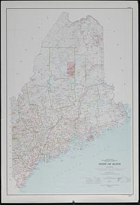
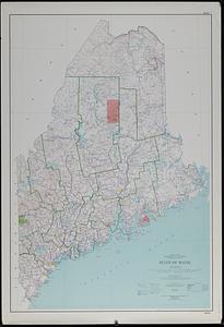
State of Maine : base map with highways and contours
325.
State of Maine : base map with highways and contours
326.
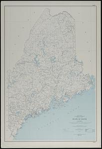
State of Maine : base map
327.
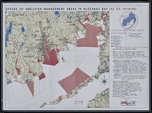
Status of shellfish management areas in Buzzards Bay (as of 10/10/90)
328.
Stoneham drain lines checkplot map sheet 3
329.
Stoneham sewer lines checkplot map sheet 1
330.
Swampscott, landuse change 1971-1985
331.
Town of Amherst, Massachusetts build out analysis - future growth study : protected lands, developable lands & new development...
332.
Town of Berkley, Massachusetts [property atlas]
333.
Town of Dedham, Norfolk County, Massachusetts
334.
Town of Grafton, Massachusetts, zoning map
335.
Town of Lincoln, Massachusetts assessor's atlas
336.
Town of North Attleborough Bristol County, Massachusetts : street map
337.
Town of Norton, Massachusetts [property atlas]
338.
Town of Plymouth [land development planning]
339.
Town of Plymouth [land development planning]
340.
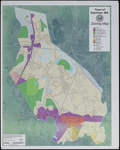
Town of Raynham, MA zoning map
‹ Prev
Next ›
1
2
…
13
14
15
16
17
18
19

![Town of Berkley, Massachusetts [property atlas]](https://bpldcassets.blob.core.windows.net/derivatives/images/commonwealth:bk12fb77t/image_thumbnail_300.jpg)

![Town of Norton, Massachusetts [property atlas]](https://bpldcassets.blob.core.windows.net/derivatives/images/commonwealth:3x81cp972/image_thumbnail_300.jpg)
![Town of Plymouth [land development planning]](https://bpldcassets.blob.core.windows.net/derivatives/images/commonwealth:tt44v120f/image_thumbnail_300.jpg)
![Town of Plymouth [land development planning]](https://bpldcassets.blob.core.windows.net/derivatives/images/commonwealth:wh24cv585/image_thumbnail_300.jpg)