Town of Amherst, Massachusetts build out analysis - future growth study : protected lands, developable lands & new development : current development trends buildout scenario
Item Information
- Title:
- Town of Amherst, Massachusetts build out analysis - future growth study : protected lands, developable lands & new development : current development trends buildout scenario
- Cartographer:
- Applied Geographics, Inc.
- Cartographer:
- Philip B. Herr & Associates
- Name on Item:
-
map production & data compilation Applied Geographics, Inc. with Philip B. Herr & Associates
- Date:
-
2002
- Format:
-
Maps/Atlases
- Location:
-
Boston Public Library
Norman B. Leventhal Map & Education Center - Collection (local):
-
Applied Geographics, Inc. Records
- Subjects:
-
Amherst (Mass. : Town)--Maps
Open spaces--Massachusetts--Amherst (Town)--Maps
Protected areas--Massachusetts--Amherst (Town)--Maps
Real estate development--Massachusetts--Amherst (Town)--Maps
- Places:
-
MassachusettsHampshire (county)Amherst
- Extent:
- 1 map : color ; 86 x 62 cm on sheet 100 x 65 cm
- Terms of Use:
-
No known copyright restrictions.
No known restrictions on use.
- Publisher:
-
[Boston] :
Applied Geographics, Inc.
- Scale:
-
Scale approximately 1:17,920
- Language:
-
English
- Notes:
-
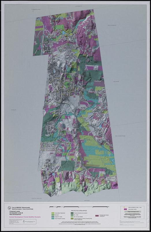
Relief shown by shading.
Indicates types of protected open space, new housing units, buildable areas, and village densification areas.
- Identifier:
-
06_01_019004
- Call #:
-
AppGeo Folder 7 no. 11
- Barcode:
-
30000008057177


