Status of shellfish management areas in Buzzards Bay (as of 10/10/90)
Item Information
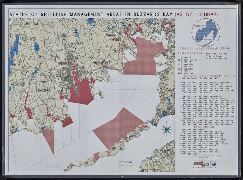
- Title:
- Status of shellfish management areas in Buzzards Bay (as of 10/10/90)
- Cartographer:
- Buzzards Bay Project (Mass.)
- Cartographer:
- Massachusetts. Executive Office of Environmental Affairs
- Contributor:
- MassGIS (Office : Mass.)
- Name on Item:
-
map prepared by Buzzards Bay Project staff
- Date:
-
1991
- Format:
-
Maps/Atlases
- Genre:
-
Thematic maps
- Location:
-
Boston Public Library
Norman B. Leventhal Map & Education Center - Collection (local):
-
Applied Geographics, Inc. Records
- Subjects:
-
Buzzards Bay (Mass.)--Maps
Shellfish gathering--Massachusetts--Buzzards Bay--Maps
- Places:
-
MassachusettsBuzzards Bay
- Extent:
- 1 map : color, plastic-coated ; 25 x 27 cm, on sheet 28 x 38 cm
- Terms of Use:
-
No known copyright restrictions.
No known restrictions on use.
- Publisher:
-
[Massachusetts] :
Buzzards Bay Project
- Scale:
-
Scale 1:52,000
- Language:
-
English
- Notes:
-
Shows shellfishing status.
- Identifier:
-
06_01_018909
- Call #:
-
AppGeo Folder 3 no. 7
- Barcode:
-
30000008056474


