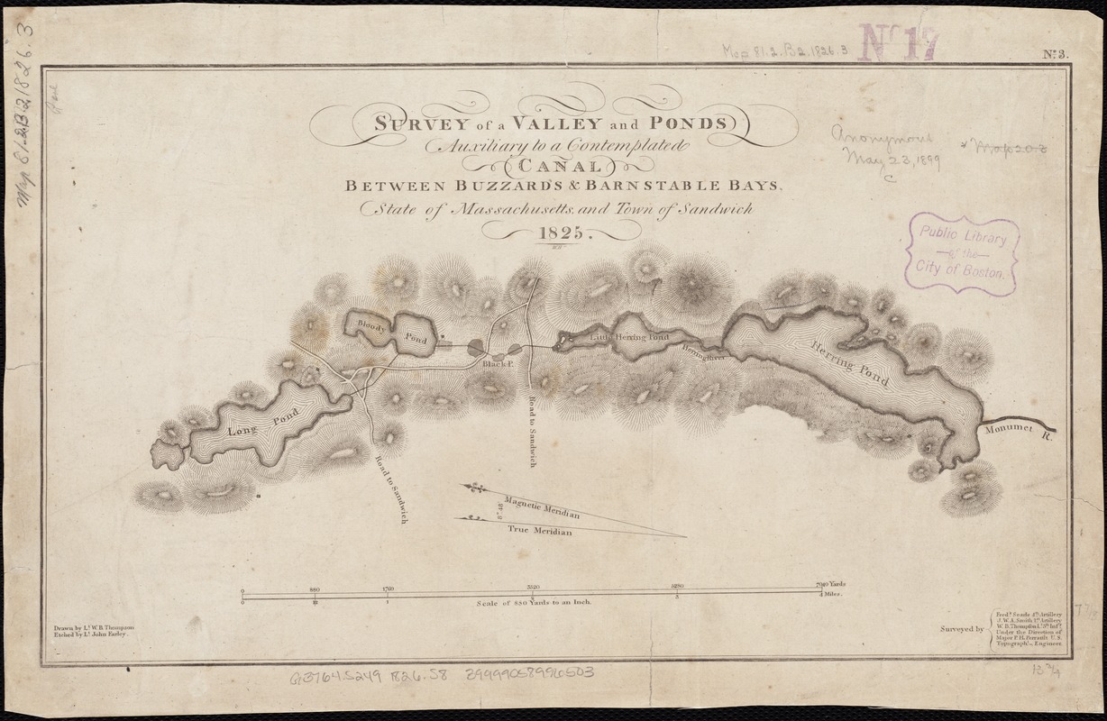
Survey of a valley and ponds auxiliary to a contemplated canal between Buzzard's & Barnstable Bays, state of Massachusetts and town of Sandwich
Item Information
- Title:
- Survey of a valley and ponds auxiliary to a contemplated canal between Buzzard's & Barnstable Bays, state of Massachusetts and town of Sandwich
- Name on Item:
-
drawn by Lt. W.B. Thompson ; etched by Lt. John Earley ; surveyed by Fredk. Searle, J.W.A. Smith, W.B. Thompson, under the direction of Major P.H. Perrault ; W.H.
- Date:
-
[1826]
- Format:
-
Maps/Atlases
- Location:
-
Boston Public Library
Norman B. Leventhal Map & Education Center - Collection (local):
-
Norman B. Leventhal Map & Education Center Collection
- Subjects:
-
Canals--Massachusetts--Cape Cod--Maps
Cape Cod Canal (Mass.)--Maps
Buzzards Bay (Mass.)--Maps
- Places:
-
MassachusettsCape Cod Canal
MassachusettsBarnstable (county)BourneBuzzards Bay
- Extent:
- 1 map ; 20 x 35 cm.
- Terms of Use:
-
No known copyright restrictions.
No known restrictions on use.
- Publisher:
-
Washington, D.C :
United States Topographical Bureau?
- Scale:
-
Scale [ca. 1:3,520].
- Language:
-
English
- Notes:
-
Relief shown by hachures.
In upper right corner: "No. 3."
Oriented with north to the upper left.
- Notes (date):
-
This date is inferred.
- Identifier:
-
06_01_002636
- Call #:
-
G3764.S249 1826 .S8
- Barcode:
-
39999058996503


