Toggle navigation
LMEC Home
Exhibitions
Georeferencing
Tools for Teachers
Collections
My Favorites
Sign Up / Log In
Search
Search the map portal
Map Collection
Map Collection
Map Sets
Search
Search
Search for
Search In
All Fields
Creator
Title
Subject
Place
Search All Digital Collections
Advanced Search
8713 Results
My Search
Start Over
More Like
commonwealth:cj82m115h
Remove constraint More Like: commonwealth:cj82m115h
Filter your Search
Place
North and Central America
5,944
United States
4,855
Massachusetts
2,079
Europe
1,396
Suffolk (county)
1,046
Boston
1,019
Canada
449
Asia
438
more
Place
»
Topic
Boston (Mass.)--Maps
586
United States--Maps
282
Real property--Massachusetts--Boston--Maps
175
Massachusetts--Maps
162
Landowners--Massachusetts--Boston--Maps
133
North America--Maps--Early works to 1800
103
New England--Maps
102
Europe--Maps
79
more
Topic
»
Date
Date range begin
–
Date range end
Current results range from
1482
to
2023
View distribution
Creator
United States. Hydrographic Office
595
O.H. Bailey & Co
148
Des Barres, Joseph F. W. (Joseph Frederick Wallet), 1722-1824
123
United States. Post Office Dept
120
Ptolemy, 2nd cent
100
Walling, Henry Francis, 1825-1888
94
Geological Survey (U.S.)
86
Jefferys, Thomas, -1771
85
more
Creator
»
Format
Maps/Atlases
8,653
Manuscripts
219
Prints
56
Books
36
Objects/Artifacts
10
Drawings/Illustrations
8
Posters
5
Georeferenced
Yes
869
No
7,844
Collection
Norman B. Leventhal Map & Education Center Collection
8,694
Boston and New England Maps
2,233
Urban Maps
2,023
Maritime Charts and Atlases
1,083
American Revolutionary War-Era Maps
634
Boston Redevelopment Authority Collection
87
Richard H. Brown Revolutionary War Map Collection at Mount Vernon
12
New-York Historical Society Collection
3
more
Collection
»
Available to use
No known restrictions
8,555
Creative Commons license
62
Search Constraints
Sort by relevance
relevance
title
date (asc)
date (desc)
Number of results to display per page
20 per page
10
per page
20
per page
50
per page
100
per page
View results as:
grid view
map view
Search Results
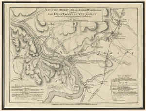
21.
Plan of the operations of General Washington, against the Kings troops in New Jersey : from the 26th. of December 1776, to the...
22.
Attaque de l'armée des provinciaux dans Long Island du 27. Aoust 1776 : dessin de l'isle de New-York et des Etats
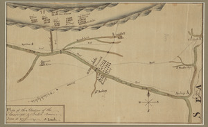
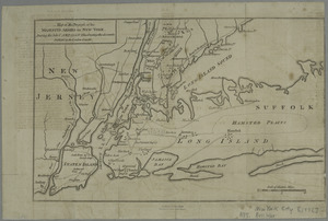
23.
The Country twenty five miles round New York
24.
Grundriss des nördlichen theils der Neujorks Insel : nebst den am 16. Novbr. 1776. eroberten Fort Washington nun das Fort...
25.
Plan des environs de New York (manuscrit) - Position du camp de l'armée combinée à Philippsburg du 6 juillet au 19 août -...
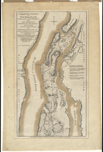
26.
A topographical map of the northn. part of New York Island, exhibiting the plan of Fort Washington, now Fort Knyphausen, with...
27.
A map of the country in which the army under Lt. General Burgoyne acted in the campaign of 1777 : shewing the marches of the...
28.
Map of the progress of His Majesty's armies in New York, during the late campaign : illustrating the accounts published in the...
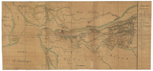
29.
[Plan of the battles of Saratoga]
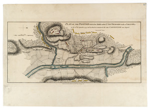
30.
Plan of the position which the army under Lt. Genl. Burgoine took at Saratoga on the 10th of September, 1777, and in which it...
31.
Chart and plan of the harbour of New York & the couny. adjacent, from Sandy Hook to Kingsbridge, comprehending the whole of New...
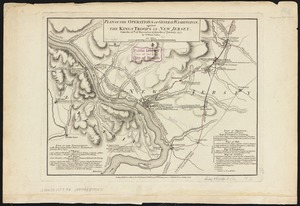
32.
Plan of the operations of General Washington, against the Kings troops in New Jersey : from the 26th. of December 1776, to the...
33.
Plan of the situation of the American & British armies, June 15st 1777
34.
The 100th anniversary map of Abraham Lincoln's visit to Massachusetts, September 11-23, 1848
35.
1630 shoreline
36.
1879. Progress map of the U.S. Geographical Surveys west of the 100th Meridian : prepared under the direction of 1st Lieut....
37.
1903 Map of Salem and surrounding places
38.
19th annual convention of the National Association of Real Estate Boards : at Tulsa, June 7 to June 11 in 1926
39.
2005 significant U.S. hurricane strikes
40.
The 2100 project : an atlas for the Green New Deal
‹ Prev
Next ›
1
2
3
4
5
6
…
435
436


![[Plan of the battles of Saratoga]](https://bpldcassets.blob.core.windows.net/derivatives/images/commonwealth:z603vw07d/image_thumbnail_300.jpg)