Toggle navigation
LMEC Home
Exhibitions
Georeferencing
Tools for Teachers
Collections
My Favorites
Sign Up / Log In
Search
Search the map portal
Map Collection
Map Collection
Map Sets
Search
Search
Search for
Search In
All Fields
Creator
Title
Subject
Place
Search All Digital Collections
Advanced Search
8802 Results
My Search
Start Over
More Like
commonwealth:cj82kt994
Remove constraint More Like: commonwealth:cj82kt994
Filter your Search
Place
North and Central America
6,033
United States
4,930
Massachusetts
2,152
Europe
1,396
Suffolk (county)
1,049
Boston
1,022
Canada
456
Asia
438
more
Place
»
Topic
Boston (Mass.)--Maps
592
United States--Maps
282
Massachusetts--Maps
235
Real property--Massachusetts--Boston--Maps
175
Landowners--Massachusetts--Boston--Maps
133
New England--Maps
127
North America--Maps--Early works to 1800
103
Europe--Maps
79
more
Topic
»
Date
Date range begin
–
Date range end
Current results range from
1482
to
2023
View distribution
Creator
United States. Hydrographic Office
595
O.H. Bailey & Co
148
Des Barres, Joseph F. W. (Joseph Frederick Wallet), 1722-1824
123
United States. Post Office Dept
120
Ptolemy, 2nd cent
100
Walling, Henry Francis, 1825-1888
95
Geological Survey (U.S.)
93
Jefferys, Thomas, -1771
86
more
Creator
»
Format
Maps/Atlases
8,741
Manuscripts
217
Prints
56
Books
36
Objects/Artifacts
10
Drawings/Illustrations
8
Posters
5
Ephemera
1
Georeferenced
Yes
882
No
7,920
Collection
Norman B. Leventhal Map & Education Center Collection
8,742
Boston and New England Maps
2,286
Urban Maps
2,024
Maritime Charts and Atlases
1,083
American Revolutionary War-Era Maps
660
Boston Redevelopment Authority Collection
90
David Judkins Weaver Papers
23
Applied Geographics, Inc. Records
20
more
Collection
»
Available to use
No known restrictions
8,600
Creative Commons license
54
Search Constraints
Sort by relevance
relevance
title
date (asc)
date (desc)
Number of results to display per page
20 per page
10
per page
20
per page
50
per page
100
per page
View results as:
grid view
map view
Search Results
4421.
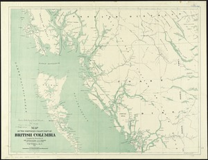
Map of the northern coast part of British Columbia
4422.
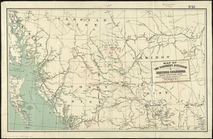
Map of the northern interior of British Columbia shewing undeveloped areas
4423.
Map of the northern, or, New England states of America, comprehending Vermont, New Hampshire, District of Main, Massachusetts,...
4424.
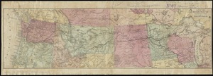
Map of the Northern Pacific R.R. its connections and tributary country
4425.
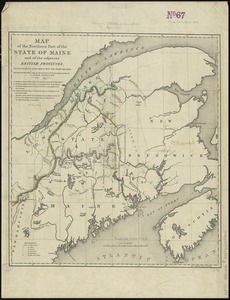
Map of the northern part of the state of Maine and of the adjacent British provinces : shewing the portion of that state to...
4426.
Map of the northern part of the state of New York
4427.
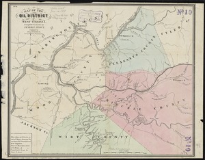
Map of the oil district of West Virginia
4428.
[Map of the operations at the seige of Savannah in 1779, by the French and American forces]
4429.
Map of the Orange River Colony
4430.
Map of the Oranges, and Irvington, New Jersey
4431.
Map of the Oregon Territory
4432.
Map of the original grants of village lots from the Dutch West India Company to the inhabitants of New-Amsterdam (now New-York)...
4433.
Map of the original town of Newbury, now divided into Newbury, Newburyport and West Newbury
4434.
Map of the Parish of Tensas, Louisiana : from United States Surveys
4435.
Map of the part of the boroughs of Manhattan and Bronx, New York City
4436.
Map of the Peloponnese during the Peloponnesian War
4437.
Map of the Philippine Islands and Sulu Archipelago
4438.
Map of the principal part of Boston, and adjacent cities, for 1873
4439.
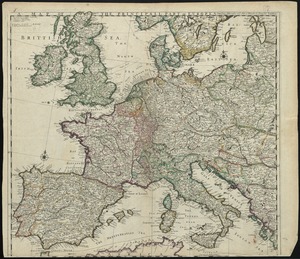
A map of the principall part of Europe
4440.
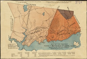
Map of the proposed town of Beverly Farms, Mass : presented by the Petitioners
‹ Prev
Next ›
1
2
…
218
219
220
221
222
223
224
225
226
…
440
441


![[Map of the operations at the seige of Savannah in 1779, by the French and American forces]](https://bpldcassets.blob.core.windows.net/derivatives/images/commonwealth:9s161g724/image_thumbnail_300.jpg)