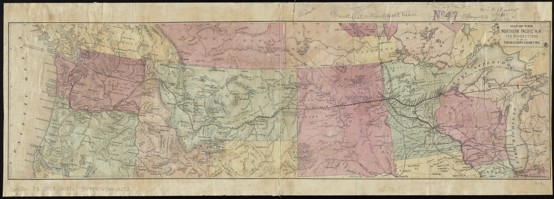
Map of the Northern Pacific R.R. its connections and tributary country
Item Information
- Title:
- Map of the Northern Pacific R.R. its connections and tributary country
- Date:
-
[1880–1889]
- Format:
-
Maps/Atlases
- Location:
-
Boston Public Library
Norman B. Leventhal Map & Education Center - Collection (local):
-
Norman B. Leventhal Map & Education Center Collection
- Subjects:
-
Northern Pacific Railroad Company
Railroads--Middle West--Maps
Railroads--Northwestern States--Maps
Middle West--Maps
Northwestern States--Maps
- Places:
-
Midwest (area)
Great Plains (area)
Northwestern United States (area)
- Extent:
- 1 map : col. ; 20 x 70 cm.
- Terms of Use:
-
No known copyright restrictions.
No known restrictions on use.
- Publisher:
-
Philadelphia :
National Railway Publication Company
- Scale:
-
Scale [ca. 1:4,800,000]
- Language:
-
English
- Notes:
-
Relief shown by hachures and spot heights.
Shows southern portion of Canada, railroad lines across northern United States from Pacific coast to the Great Lakes, mineral resources, military posts, towns, Yellowstone National Park, and Dakota Territory; Minnesota divided into township grid.
Date range of map determined from extent of Northern Pacific Railroad lines in Washington.
- Notes (date):
-
This date is inferred.
- Identifier:
-
06_01_009237
- Call #:
-
G4126.P3 1883 .M37x
- Barcode:
-
39999065660472


