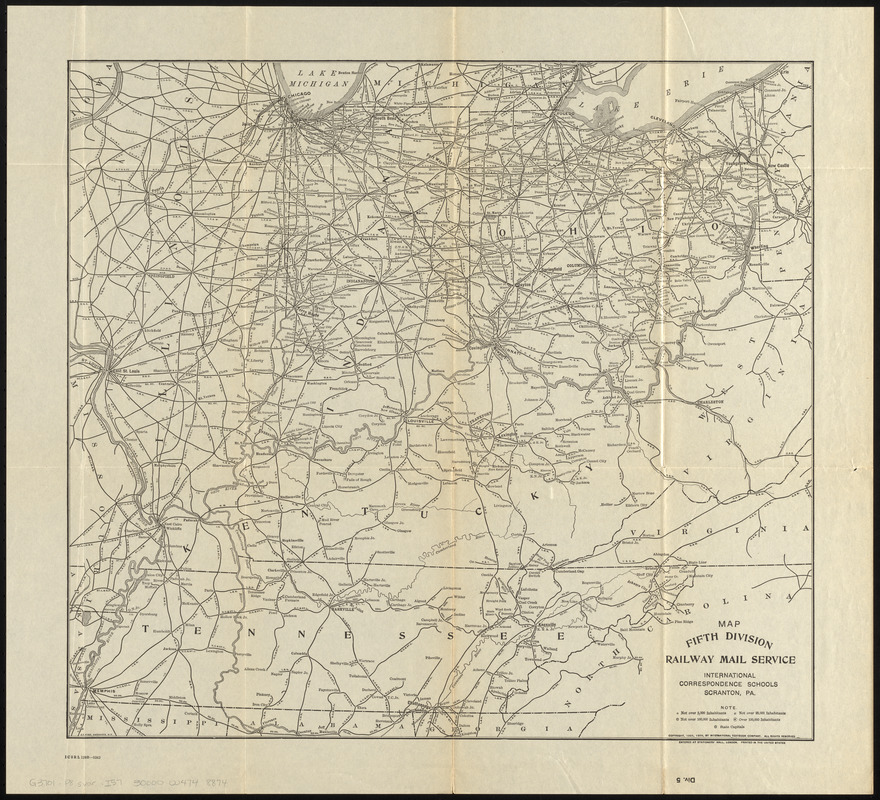
Map fifth division railway mail service
Item Information
- Title:
- Map fifth division railway mail service
- Title (alt.):
-
Fifth Division railway mail service
Div. 5
- Description:
-
Map showing railway mail service lines in Middle Western states of the Ohio Valley (principally Ohio, Indiana, Illinois, Kentucky and Tennessee) in the early 20th century.
- Cartographer:
- International Correspondence Schools
- Engraver:
- Fisk, E. F.
- Copyright holder:
- International Textbook Company
- Name on Item:
-
International Correspondence Schools ; E.F. Fisk, engraver
- Date:
-
1908
- Format:
-
Maps/Atlases
- Location:
-
Boston Public Library
Norman B. Leventhal Map & Education Center - Collection (local):
-
Norman B. Leventhal Map & Education Center Collection
- Subjects:
-
Postal service--Middle West--Maps
Railroads--Middle West--Maps
Railway mail service--Middle West--Maps
Railway mail service--Illinois--Maps
Railway mail service--Indiana--Maps
Railway mail service--Kentucky--Maps
Railway mail service--Ohio--Maps
Railway mail service--Tennessee--Maps
Middle West--Maps
- Places:
-
Midwest (area)
- Extent:
- 1 map ; 46 x 50 cm
- Terms of Use:
-
No known copyright restrictions.
No known restrictions on use.
- Publisher:
-
Scranton, Pennsylvania :
International Correspondence Schools
- Scale:
-
Scale approximately 1:1,800,000
- Language:
-
English
- Notes:
-
Copyright assigned to the International Textbook Company.
"Entered at Stationers' Hall, London -- Printed in the United States."
"ICSRL 129B-3242."
Part of the I.C.S. reference library maps set.
- Identifier:
-
06_01_014811
- Call #:
-
G3701.P8 svar .I57
- Barcode:
-
30000004748874