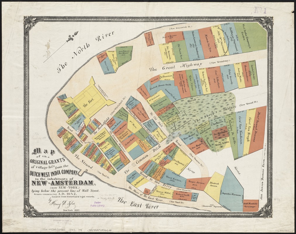
Map of the original grants of village lots from the Dutch West India Company to the inhabitants of New-Amsterdam (now New-York) lying below the present line of Wall Street : grants commencing A.D. 1642
Item Information
- Title:
- Map of the original grants of village lots from the Dutch West India Company to the inhabitants of New-Amsterdam (now New-York) lying below the present line of Wall Street : grants commencing A.D. 1642
- Creator:
- Tyler, Henry D. (Henry Dunreath), b. 1834
- Name on Item:
-
by Henry Dunreath Tyler.
- Date:
-
[1897?]
- Format:
-
Maps/Atlases
- Location:
-
Boston Public Library
Norman B. Leventhal Map & Education Center - Collection (local):
-
Norman B. Leventhal Map & Education Center Collection
- Subjects:
-
Land grants--New York (State)--New York--Maps
Real property--New York (State)--New York--Maps
Manhattan (New York, N.Y.)--Maps
- Places:
-
New YorkNew York
- Extent:
- 1 map : col. ; 40 x 50 cm.
- Terms of Use:
-
No known copyright restrictions.
No known restrictions on use.
- Publisher:
-
New York :
Dunreath Publishing Co.
- Scale:
-
Scale [ca. 1:1,110].
- Language:
-
English
- Notes:
-
Oriented with north toward the upper right.
Cadastral map showing property lots with dimensions, names of owners, and year of grant (1642-1658), and early roads.
- Identifier:
-
06_01_003597
- Call #:
-
G3804.N4:2M3G465 1897 .T9
- Barcode:
-
39999059001626


