Toggle navigation
LMEC Home
Exhibitions
Georeferencing
Tools for Teachers
Collections
My Favorites
Sign Up / Log In
Search
Search the map portal
Map Collection
Map Collection
Map Sets
Search
Search
Search for
Search In
All Fields
Creator
Title
Subject
Place
Search All Digital Collections
Advanced Search
8877 Results
My Search
Start Over
More Like
commonwealth:cj82kp336
Remove constraint More Like: commonwealth:cj82kp336
Filter your Search
Place
North and Central America
6,108
United States
5,024
Massachusetts
2,136
Europe
1,396
Suffolk (county)
1,210
Boston
1,181
Canada
449
Asia
438
more
Place
»
Topic
Boston (Mass.)--Maps
752
United States--Maps
282
Real property--Massachusetts--Boston--Maps
196
Massachusetts--Maps
166
City planning--Massachusetts--Boston--Maps
157
Landowners--Massachusetts--Boston--Maps
143
New England--Maps
104
North America--Maps--Early works to 1800
103
more
Topic
»
Date
Date range begin
–
Date range end
Current results range from
1482
to
2023
View distribution
Creator
United States. Hydrographic Office
595
Boston Redevelopment Authority
162
O.H. Bailey & Co
148
Des Barres, Joseph F. W. (Joseph Frederick Wallet), 1722-1824
124
United States. Post Office Dept
120
Ptolemy, 2nd cent
100
Walling, Henry Francis, 1825-1888
94
Geological Survey (U.S.)
87
more
Creator
»
Format
Maps/Atlases
8,817
Manuscripts
215
Prints
56
Books
36
Objects/Artifacts
10
Drawings/Illustrations
8
Posters
5
Georeferenced
Yes
885
No
7,992
Collection
Norman B. Leventhal Map & Education Center Collection
8,725
Boston and New England Maps
2,359
Urban Maps
2,143
Maritime Charts and Atlases
1,083
American Revolutionary War-Era Maps
638
Boston Redevelopment Authority Collection
191
Massachusetts Real Estate Atlases
26
Mapping Boston Collection
20
more
Collection
»
Available to use
No known restrictions
8,666
Creative Commons license
70
Search Constraints
Sort by relevance
relevance
title
date (asc)
date (desc)
Number of results to display per page
20 per page
10
per page
20
per page
50
per page
100
per page
View results as:
grid view
map view
Search Results
681.
Zoning districts, city of Boston
682.
Zoning districts, city of Boston
683.
Zoning districts, city of Boston
684.
Atlas of the city of Somerville, Massachusetts
685.
Atlas of the city of Chelsea and the towns of Revere & Winthrop, Massachusetts
686.
Atlas of the city of Chelsea and the towns of Revere and Winthrop, Massachusetts
687.
Atlas of the county of Suffolk, Massachusetts, vol. 4 : including East Boston, city of Chelsea, Revere and Winthrop
688.
Atlas of the town of Brookline, Norfolk County, Massachusetts
689.
Atlas of the town of Brookline, Norfolk County, Massachusetts
690.
Atlas of the town of Brookline, Norfolk County, Massachusetts
691.
Atlas of the town of Brookline, Norfolk County, Massachusetts
692.
Atlas of the city of Cambridge, Massachusetts
693.
Atlas of the city of Cambridge, Massachusetts
694.
Atlas of the city of Cambridge, Massachusetts
695.
Atlas of the city of Cambridge, Massachusetts
696.
Atlas of the city of Cambridge, Middlesex Co., Massachusetts
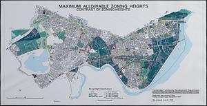
697.
Maximum allowable zoning heights : contrast of zoning heights
698.
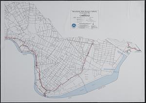
Sewerage division map city of Cambridge
699.
1975 general land use plan
700.
An accurate plan of the town of Boston and its vicinity : exhibiting a ground plan of all the streets, lanes, alleys, wharves,...
‹ Prev
Next ›
1
2
…
31
32
33
34
35
36
37
38
39
…
443
444