Toggle navigation
LMEC Home
Exhibitions
Georeferencing
Tools for Teachers
Collections
My Favorites
Sign Up / Log In
Search
Search the map portal
Map Collection
Map Collection
Map Sets
Search
Search
Search for
Search In
All Fields
Creator
Title
Subject
Place
Search All Digital Collections
Advanced Search
8301 Results
My Search
Start Over
More Like
commonwealth:cc08kx763
Remove constraint More Like: commonwealth:cc08kx763
Filter your Search
Place
North and Central America
5,050
United States
3,740
Suffolk (county)
1,164
Boston
1,137
Europe
963
Canada
427
France
269
Massachusetts
260
more
Place
»
Topic
Boston (Mass.)--Maps
600
United States--Maps
270
Real property--Massachusetts--Boston--Maps
220
Landowners--Massachusetts--Boston--Maps
167
City planning--Massachusetts--Boston--Maps
161
Massachusetts--Maps
160
Buildings--Massachusetts--Boston--Maps
122
North America--Maps--Early works to 1800
103
more
Topic
»
Date
Date range begin
–
Date range end
Current results range from
1482
to
2023
View distribution
Creator
United States. Hydrographic Office
357
Boston Redevelopment Authority
161
O.H. Bailey & Co
148
Des Barres, Joseph F. W. (Joseph Frederick Wallet), 1722-1824
123
United States. Post Office Dept
120
Ptolemy, 2nd cent
100
Walling, Henry Francis, 1825-1888
94
Bromley, George Washington
85
more
Creator
»
Format
Maps/Atlases
8,242
Manuscripts
215
Prints
51
Books
36
Objects/Artifacts
10
Drawings/Illustrations
8
Posters
4
Georeferenced
Yes
869
No
7,432
Collection
Norman B. Leventhal Map Center Collection
8,164
Boston and New England Maps
2,288
Urban Maps
2,029
Maritime Charts and Atlases
750
American Revolutionary War-Era Maps
616
Boston Redevelopment Authority Collection
189
Massachusetts Real Estate Atlases
34
Available to use
No known restrictions
8,126
Creative Commons license
46
Search Constraints
Sort by relevance
relevance
title
date (asc)
date (desc)
Number of results to display per page
20 per page
10
per page
20
per page
50
per page
100
per page
View results as:
grid view
map view
Search Results
1.
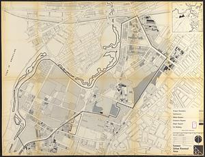
Fenway urban renewal area : building conditions
2.
Parker Hill-Fenway urban renewal area r-48 : building conditions
3.
Parker Hill-Fenway urban renewal area r-48 : existing building coverage
4.
Boston University, Charles River campus master plan
5.
Charlestown Navy Yard area
6.
Charlestown urban renewal project Boston (Suffolk County) Massachusetts Mass. R-55 : topographic map
7.
City of Boston : topographic and planimetric survey
8.
Columbia Point development study
9.
Columbia Point updated base maps
10.
Flirtation walk schematic planting plan Charlestown Navy Yard
11.
Infrastructure around Tobin Bridge/US route 1 in Charlestown
12.
Landscaping plan of City Hall Plaza, Boston
13.
Map of the city of Boston, Massts., 1852
14.
Ropewalk bldg. Charlestown Navy Yard
15.
Shadow analysis
16.
Shipyard Park phase 3 : Boston Naval Shipyard at Charlestown : schematic design
17.
View of the South End
18.
Washington Street corridor : South Cove to Forest Hills
19.
Area plan as of May 1962
20.
Atlas of the city of Boston : Roxbury : from actual surveys and official plans
‹ Prev
Next ›
1
2
3
4
5
…
415
416