Toggle navigation
LMEC Home
Exhibitions
Georeferencing
Tools for Teachers
Collections
My Favorites
Sign Up / Log In
Search
Search the map portal
Map Collection
Map Collection
Map Sets
Search
Search
Search for
Search In
All Fields
Creator
Title
Subject
Place
Search All Digital Collections
Advanced Search
8168 Results
My Search
Start Over
More Like
commonwealth:9g54z626j
Remove constraint More Like: commonwealth:9g54z626j
Filter your Search
Place
North and Central America
4,917
United States
3,607
Suffolk (county)
1,031
Boston
1,004
Europe
963
Canada
427
France
269
Massachusetts
249
more
Place
»
Topic
Boston (Mass.)--Maps
574
United States--Maps
270
Real property--Massachusetts--Boston--Maps
174
Massachusetts--Maps
160
Landowners--Massachusetts--Boston--Maps
132
North America--Maps--Early works to 1800
103
New England--Maps
99
Europe--Maps
78
more
Topic
»
Date
Date range begin
–
Date range end
Current results range from
1482
to
2023
View distribution
Creator
United States. Hydrographic Office
357
O.H. Bailey & Co
148
Des Barres, Joseph F. W. (Joseph Frederick Wallet), 1722-1824
123
United States. Post Office Dept
120
Ptolemy, 2nd cent
100
Walling, Henry Francis, 1825-1888
94
Jefferys, Thomas, -1771
84
Geological Survey (U.S.)
82
more
Creator
»
Format
Maps/Atlases
8,109
Manuscripts
215
Prints
51
Books
36
Objects/Artifacts
10
Drawings/Illustrations
8
Posters
4
Georeferenced
Yes
869
No
7,299
Collection
Norman B. Leventhal Map Center Collection
8,163
Boston and New England Maps
2,189
Urban Maps
1,930
Maritime Charts and Atlases
750
American Revolutionary War-Era Maps
616
Boston Redevelopment Authority Collection
91
Available to use
No known restrictions
8,027
Creative Commons license
46
Search Constraints
Sort by relevance
relevance
title
date (asc)
date (desc)
Number of results to display per page
20 per page
10
per page
20
per page
50
per page
100
per page
View results as:
grid view
map view
Search Results
1.
Map of Boston Common and Public Garden
2.
Plan of Public Garden : showing proposed arrangement of lots thereon
3.
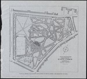
General plan for Boston Common
4.
Plan for the construction of improvements at the Boston Common
5.
Proposed park system from the Common to the West Roxbury Park including the Back Bay and Muddy river improvements, Jamaica Pond...
6.
Boston Elevated Railway lines 1921
7.
Boston Elevated Railway lines operated 1925
8.
Boston Elevated Railway system
9.
Boston Elevated Railway track lengths of surface lines and subway
10.
Boston Elevated Railway track lengths of surface lines and subway
11.
Boston Subway, East Boston Tunnel, Washington St. Tunnel, tunnel for Cambridge connection & proposed Riverbank Subway
12.
Central part of Boston Elevated Railway system showing connections
13.
Central part of Boston Elevated Railway system showing connections
14.
Central part of Boston Elevated Railway system showing connections 1903
15.
Central part of Boston Elevated Railway system showing connections 1904
16.
Map of Boston
17.
Map of Boston and vicinity, showing tracks operated by the Boston Elevated Railway Co. January, 1910
18.
Map of Boston proper
19.
[Map of Boston, showing surface lines, proposed elevated lines, connecting surface lines and route of subway
20.
Map of the Boston Elevated Ry. 1915
‹ Prev
Next ›
1
2
3
4
5
…
408
409