Toggle navigation
LMEC Home
Exhibitions
Georeferencing
Tools for Teachers
Collections
My Favorites
Sign Up / Log In
Search
Search the map portal
Map Collection
Map Collection
Map Sets
Search
Search
Search for
Search In
All Fields
Creator
Title
Subject
Place
Search All Digital Collections
Advanced Search
8170 Results
My Search
Start Over
More Like
commonwealth:9g54xt43r
Remove constraint More Like: commonwealth:9g54xt43r
Filter your Search
Place
North and Central America
4,919
United States
3,609
Suffolk (county)
1,026
Boston
999
Europe
963
Canada
427
France
269
Massachusetts
250
more
Place
»
Topic
Boston (Mass.)--Maps
574
United States--Maps
270
Real property--Massachusetts--Boston--Maps
174
Massachusetts--Maps
160
Landowners--Massachusetts--Boston--Maps
132
North America--Maps--Early works to 1800
103
New England--Maps
99
Europe--Maps
78
more
Topic
»
Date
Date range begin
–
Date range end
Current results range from
1482
to
2023
View distribution
Creator
United States. Hydrographic Office
357
O.H. Bailey & Co
148
Des Barres, Joseph F. W. (Joseph Frederick Wallet), 1722-1824
123
United States. Post Office Dept
120
Ptolemy, 2nd cent
100
Walling, Henry Francis, 1825-1888
94
Jefferys, Thomas, -1771
84
Geological Survey (U.S.)
82
more
Creator
»
Format
Maps/Atlases
8,111
Manuscripts
215
Prints
51
Books
36
Objects/Artifacts
10
Drawings/Illustrations
8
Posters
4
Georeferenced
Yes
869
No
7,301
Collection
Norman B. Leventhal Map Center Collection
8,164
Boston and New England Maps
2,185
Urban Maps
1,926
Maritime Charts and Atlases
750
American Revolutionary War-Era Maps
616
Boston Redevelopment Authority Collection
86
Massachusetts Real Estate Atlases
6
Applied Geographics, Inc. Records
1
Available to use
No known restrictions
8,023
Creative Commons license
46
Search Constraints
Sort by relevance
relevance
title
date (asc)
date (desc)
Number of results to display per page
20 per page
10
per page
20
per page
50
per page
100
per page
View results as:
grid view
map view
Search Results
41.
[Mill dam survey : Boston, Roxbury, Brookline &c.]
42.
Mount Auburn, avenues and paths
43.
A new & complete map of the city of Boston, with part of Charlestown, Cambridge & Roxbury
44.
A new & complete map of the city of Boston, with part of Charlestown, Cambridge & Roxbury
45.
A new & complete map of the city of Boston, with part of Charlestown, Cambridge & Roxbury
46.
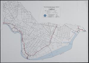
The people's republic of Cambridge
47.
Plan of Mount Auburn
48.
Plan of the cemetery of Mount Auburn
49.
Proposed Charles River Park
50.
Proposed Charles River Park
51.
Atlas of Middlesex County. Vol. 1. Cambridge, Somerville, Arlington, Belmont, Watertown, Everett, Malden, Medford, Newton,...
52.
Sewerage division map city of Cambridge
53.
The 100th anniversary map of Abraham Lincoln's visit to Massachusetts, September 11-23, 1848
54.
1630 shoreline
55.
1879. Progress map of the U.S. Geographical Surveys west of the 100th Meridian : prepared under the direction of 1st Lieut....
56.
1903 Map of Salem and surrounding places
57.
19th annual convention of the National Association of Real Estate Boards : at Tulsa, June 7 to June 11 in 1926
58.
2005 significant U.S. hurricane strikes
59.
The 2100 project : an atlas for the Green New Deal
60.
227 Harzgerode
‹ Prev
Next ›
1
2
3
4
5
6
7
…
408
409