Toggle navigation
LMEC Home
Exhibitions
Georeferencing
Tools for Teachers
Collections
My Favorites
Sign Up / Log In
Search
Search the map portal
Map Collection
Map Collection
Map Sets
Search
Search
Search for
Search In
All Fields
Creator
Title
Subject
Place
Search All Digital Collections
Advanced Search
494 Results
My Search
Start Over
More Like
commonwealth:7h14cx062
Remove constraint More Like: commonwealth:7h14cx062
Filter your Search
Place
North and Central America
491
United States
488
Suffolk (county)
480
Boston
479
Massachusetts
181
South End
55
Roxbury
48
Back Bay
44
more
Place
»
Topic
City planning--Massachusetts--Boston--Maps
418
Urban renewal--Massachusetts--Boston--Maps
253
Boston (Mass.)--Maps
131
Land use--Massachusetts--Boston--Maps
102
Buildings--Massachusetts--Boston--Maps
82
Real property--Massachusetts--Boston--Maps
54
South End (Boston, Mass.)--Maps
48
Back Bay (Boston, Mass.)--Maps
46
more
Topic
»
Date
Date range begin
–
Date range end
Current results range from
1835
to
2017
View distribution
Creator
Boston Redevelopment Authority
371
Downtown Waterfront Corporation
10
Victor Gruen Associates
10
Boston (Mass.). Parks and Recreation Department
9
Boston Zoning Commission
6
Sasaki Associates
6
Boston (Mass.). City Planning Board
5
Boston (Mass.). Department of Parks
5
more
Creator
»
Format
Maps/Atlases
493
Drawings/Illustrations
3
Manuscripts
1
Prints
1
Georeferenced
Yes
3
No
491
Collection
Boston and New England Maps
486
Urban Maps
468
Boston Redevelopment Authority Collection
440
Norman B. Leventhal Map & Education Center Collection
108
Applied Geographics, Inc. Records
2
Available to use
No known restrictions
492
Creative Commons license
1
Search Constraints
Sort by relevance
relevance
title
date (asc)
date (desc)
Number of results to display per page
20 per page
10
per page
20
per page
50
per page
100
per page
View results as:
grid view
map view
Search Results
141.
Proposed improvement of Back Bay
142.
City of Boston zoning map
143.
Zoning districts - city of Boston - map 1 - Boston proper
144.
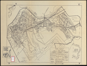
Zoning districts city of Boston map 3 East Boston
145.
Blue Hill Avenue commercial strip
146.
Boston University, Charles River campus master plan
147.
Use of land in Boston
148.
City of Boston zoning map
149.
Zoning districts, city of Boston
150.
Zoning districts, city of Boston
151.
Zoning districts, city of Boston
152.
City of Boston open space
153.
Map of Boston inner harbor to accompany report under chapter 93, resolves of 1907, December 1, 1907
154.
Basement plan of terminal station at Boston, Massachusetts, for the N.Y.N.H & H. and B. & A. railroads
155.
Boston Harbor : challenges and opportunities for the 1980's
156.
Boston thorofare plan existing routes and proposals
157.
Campus High School urban renewal area Mass. r- : locality map blighted areas
158.
Campus High School urban renewal area Mass. r- : locality map important features
159.
Campus High School urban renewal area, Mass. r- : land disposition map
160.
Campus High School urban renewal area Mass. r- : building conditions
‹ Prev
Next ›
1
2
…
4
5
6
7
8
9
10
11
12
…
24
25