Toggle navigation
LMEC Home
Exhibitions
Georeferencing
Tools for Teachers
Collections
My Favorites
Sign Up / Log In
Search
Search the map portal
Map Collection
Map Collection
Map Sets
Search
Search
Search for
Search In
All Fields
Creator
Title
Subject
Place
Search All Digital Collections
Advanced Search
9052 Results
My Search
Start Over
More Like
commonwealth:7d27c9549
Remove constraint More Like: commonwealth:7d27c9549
Filter your Search
Place
North and Central America
6,283
United States
5,201
Massachusetts
2,155
Suffolk (county)
1,403
Europe
1,396
Boston
1,376
Canada
449
Asia
438
more
Place
»
Topic
Boston (Mass.)--Maps
677
City planning--Massachusetts--Boston--Maps
418
United States--Maps
282
Urban renewal--Massachusetts--Boston--Maps
252
Real property--Massachusetts--Boston--Maps
217
Massachusetts--Maps
162
Landowners--Massachusetts--Boston--Maps
136
North America--Maps--Early works to 1800
103
more
Topic
»
Date
Date range begin
–
Date range end
Current results range from
1482
to
2023
View distribution
Creator
United States. Hydrographic Office
595
Boston Redevelopment Authority
390
O.H. Bailey & Co
148
Des Barres, Joseph F. W. (Joseph Frederick Wallet), 1722-1824
123
United States. Post Office Dept
120
Ptolemy, 2nd cent
100
Walling, Henry Francis, 1825-1888
94
Geological Survey (U.S.)
86
more
Creator
»
Format
Maps/Atlases
8,991
Manuscripts
215
Prints
56
Books
36
Objects/Artifacts
10
Drawings/Illustrations
9
Posters
5
Georeferenced
Yes
870
No
8,182
Collection
Norman B. Leventhal Map & Education Center Collection
8,696
Boston and New England Maps
2,586
Urban Maps
2,373
Maritime Charts and Atlases
1,083
American Revolutionary War-Era Maps
620
Boston Redevelopment Authority Collection
438
William L. Clements Library Collection
3
Mapping Boston Collection
2
more
Collection
»
Available to use
No known restrictions
8,904
Creative Commons license
49
Search Constraints
Sort by relevance
relevance
title
date (asc)
date (desc)
Number of results to display per page
20 per page
10
per page
20
per page
50
per page
100
per page
View results as:
grid view
map view
Search Results
5121.
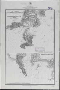
Mediterranean Sea, harbors on the south coast of Sardinia : from a British survey in 1865 ; republished from British Admiralty...
5122.
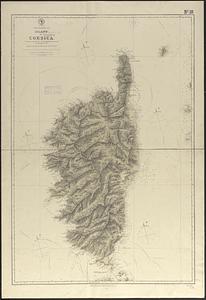
Mediterranean Sea, island of Corsica
5123.
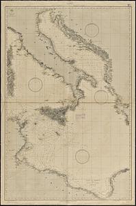
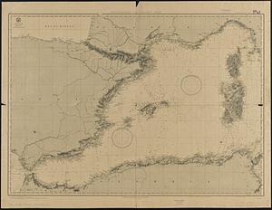
Mediterranean Sea, middle sheet
5124.
Mediterranean Sea, middle sheet
5125.
Mediterranean Sea, plans on the coasts of Italy and Sicilia
5126.
Mediterranean Sea, Port of Algier and approaches
5127.
Mediterranean Sea, s.e. coast of Spain, Port Alicante
5128.
Mediterranean Sea, Strait of Messina : from French and British surveys, corrected to 1871
5129.
Mediterranean Sea, the west coast of Italy, sheet III, from Civita Vecchia to the Gulf of S. Eufemia
5130.
Mediterranean Sea, west coast of Italy, Avenza Road
5131.
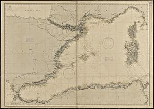
Mediterranean Sea, western sheet
5132.
Mediterranean Sea, western sheet
5133.
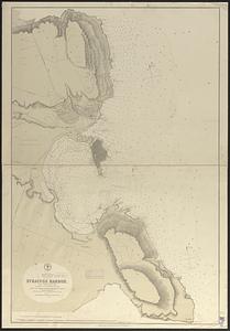
Mediterranean, Sicily, east coast, Syracuse Harbor : from a British survey in 1868 ; republication of Brit. Admty. chart no. 182
5134.
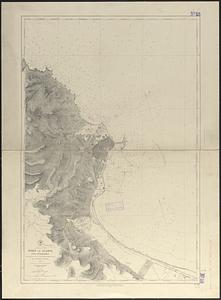
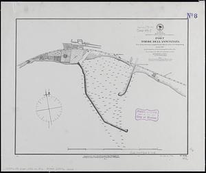
Mediterranean, south west coast of Italy, Gulf of Naples, Port Torre dell'Annunziata
5135.
Meiguo Sanfan Shi hua qiao qu : xiang xi tu = Map of San Francisco Chinatown
5136.
Meklenburg Ducatus
5137.
Melbourne
5138.
Melbourne and suburbs
5139.
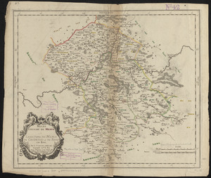
Meldi : evesché de Meaux : eslections de Meaux de Colomiers et de Rosoy en Brie
5140.
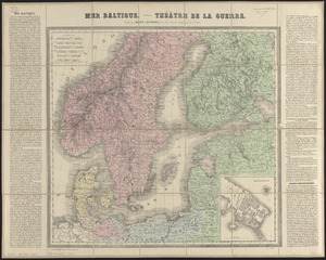
Mer Baltique : théâtre de la guerre
‹ Prev
Next ›
1
2
…
253
254
255
256
257
258
259
260
261
…
452
453