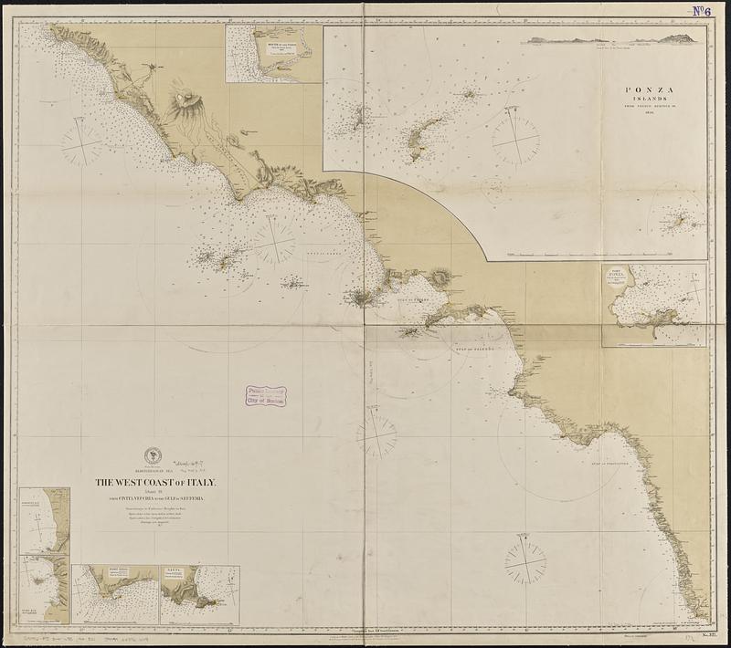
Mediterranean Sea, the west coast of Italy, sheet III, from Civita Vecchia to the Gulf of S. Eufemia
Item Information
- Title:
- Mediterranean Sea, the west coast of Italy, sheet III, from Civita Vecchia to the Gulf of S. Eufemia
- Issuing body:
- United States. Hydrographic Office
- Date:
-
[1878]
- Format:
-
Maps/Atlases
- Genre:
-
Nautical charts
- Location:
-
Boston Public Library
Norman B. Leventhal Map & Education Center - Collection (local):
-
Norman B. Leventhal Map & Education Center Collection
- Subjects:
-
Mediterranean Coast (Italy)--Maps
Coasts--Italy--Maps
Nautical charts--Italy--Mediterranean Coast
- Places:
-
Italy
- Extent:
- 1 map ; 84 x 96 cm
- Terms of Use:
-
No known copyright restrictions.
No known restrictions on use.
- Publisher:
-
Washington, D.C. :
Hydrographic Office
- Scale:
-
Scale approximately 1:420,000
- Language:
-
English
- Notes:
-
Relief shown by hachures and spot heights. Depths shown by soundings and isolines.
Includes coastal view of the Ponza Islands.
Insets: Mouth of the Tiber -- Ponza Islands -- Port Ponza -- Agropoli Bay -- Dino Bay -- Port Anzo -- Gaeta.
Also shows range of visibility of lighthouses.
"Cor. (33.III.78)(137.XII.78)."
- Notes (date):
-
This date is inferred.
- Identifier:
-
06_01_017665
- Call #:
-
G9096.P5 svar .U55 no. 321
- Barcode:
-
39999085961249