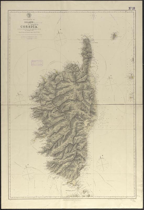
Mediterranean Sea, island of Corsica
Item Information
- Title:
- Mediterranean Sea, island of Corsica
- Issuing body:
- United States. Hydrographic Office
- Surveyor:
- Hell, M.
- Name on Item:
-
surveyed by Captain Hell, of the French Royal Navy 1824, with corrections to 1875 ; republication of British Admty. chart no. 1131
- Date:
-
1875
- Format:
-
Maps/Atlases
- Genre:
-
Nautical charts
- Location:
-
Boston Public Library
Norman B. Leventhal Map & Education Center - Collection (local):
-
Norman B. Leventhal Map & Education Center Collection
- Subjects:
-
Corsica (France)--Maps
Nautical charts--France--Corsica
- Places:
-
FranceCorsica (region)Corsica (island)
- Extent:
- 1 map ; 90 x 60 cm
- Terms of Use:
-
No known copyright restrictions.
No known restrictions on use.
- Publisher:
-
Washington, D.C. :
Hydrographic Office
- Scale:
-
Scale approximately 1:260,000
- Language:
-
English
- Notes:
-
Relief shown by hachures and spot heights. Depths shown by soundings.
Also shows range of visibility of lighthouses.
- Identifier:
-
06_01_017659
- Call #:
-
G9096.P5 svar .U55 no. 345
- Barcode:
-
39999085962387