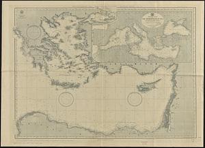
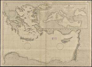
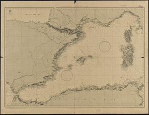
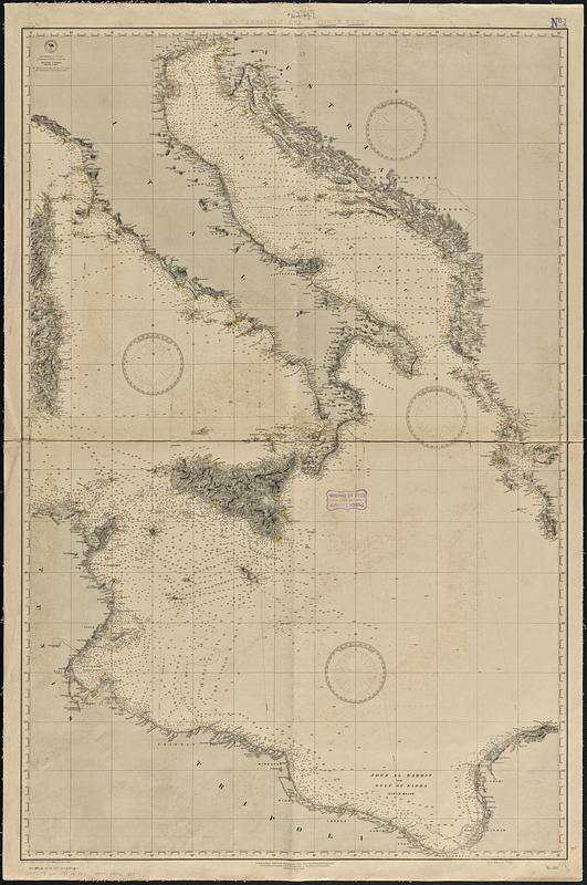
Mediterranean Sea, middle sheet
Item Information
- Title:
- Mediterranean Sea, middle sheet
- Issuing body:
- United States. Hydrographic Office
- Date:
-
[1889]
- Format:
-
Maps/Atlases
- Genre:
-
Nautical charts
- Location:
-
Boston Public Library
Norman B. Leventhal Map & Education Center - Collection (local):
-
Norman B. Leventhal Map & Education Center Collection
- Subjects:
-
Mediterranean Sea--Maps
Nautical charts--Mediterranean Sea
- Places:
-
Mediterranean Sea
- Extent:
- 1 map : hand color ; 116 x 75 cm
- Terms of Use:
-
No known copyright restrictions.
No known restrictions on use.
- Publisher:
-
Washington, D.C. :
Hydrographic Office
- Edition:
- Edition of April 1888
- Scale:
-
Scale approximately 1:1,350,000--1:1,650,000
- Language:
-
English
- Notes:
-
Relief shown by hachures and spot heights. Depths shown by soundings and isolines.
Colored to show lighthouses and notes range of visibility.
"Cor. 1888.23.26.27.39.45.50.37.54)('89-1.6,16."
- Notes (date):
-
This date is inferred.
- Identifier:
-
06_01_017680
- Call #:
-
G9096.P5 svar .U55 no. 282
- Barcode:
-
39999085961397