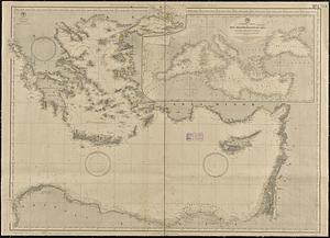
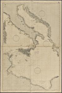
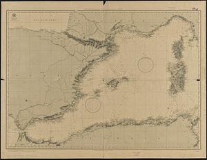
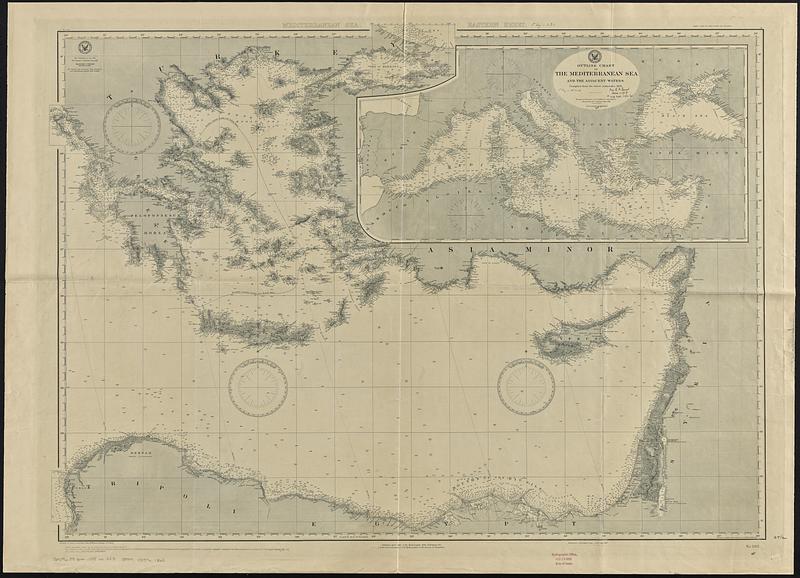
Mediterranean Sea, eastern sheet
Item Information
- Title:
- Mediterranean Sea, eastern sheet
- Issuing body:
- United States. Hydrographic Office
- Date:
-
[1906]
- Format:
-
Maps/Atlases
- Genre:
-
Nautical charts
- Location:
-
Boston Public Library
Norman B. Leventhal Map & Education Center - Collection (local):
-
Norman B. Leventhal Map & Education Center Collection
- Subjects:
-
Mediterranean Sea--Maps
Nautical charts--Mediterranean Sea
- Places:
-
Mediterranean Sea
- Extent:
- 1 map ; 77 x 107 cm
- Terms of Use:
-
No known copyright restrictions.
No known restrictions on use.
- Publisher:
-
Washington, D.C. :
Hydrographic Office
- Scale:
-
Scale approximately 1:1,480,000--1:1,650,000
- Language:
-
English
- Notes:
-
Relief shown by hachures and spot heights. Depths shown by soundings and isolines.
Inset: Outline chart of the Mediterranean Sea and the adjacent waters.
Stamped in bottom margin: Hydrographic Office, Feb 10 1906, date of issue.
Small corrections from notices to mariners from '90-52 to '05-18.
Small corrections from other sources from II'93 to X1900.
"Extensive corrections Nov., 1890, June, 1898."
- Notes (date):
-
This date is inferred.
- Identifier:
-
06_01_017677
- Call #:
-
G9096.P5 svar .U55 no. 283
- Barcode:
-
39999085961363