Toggle navigation
LMEC Home
Exhibitions
Georeferencing
Tools for Teachers
Collections
My Favorites
Sign Up / Log In
Search
Search the map portal
Map Collection
Map Collection
Map Sets
Search
Search
Search for
Search In
All Fields
Creator
Title
Subject
Place
Search All Digital Collections
Advanced Search
318 Results
My Search
Start Over
More Like
commonwealth:7940db07b
Remove constraint More Like: commonwealth:7940db07b
Filter your Search
Place
North and Central America
303
United States
286
Massachusetts
269
Suffolk (county)
51
Boston
50
Rhode Island
31
Connecticut
21
New England
16
more
Place
»
Topic
Massachusetts--Maps
235
Boston (Mass.)--Maps
48
Rhode Island--Maps
32
Railroads--Massachusetts--Maps
31
Connecticut--Maps
22
Roads--Massachusetts--Maps
19
New England--Maps
16
Coasts--Massachusetts--Maps
11
more
Topic
»
Date
Date range begin
–
Date range end
Current results range from
1760
to
2020
View distribution
Creator
MassGIS (Office : Mass.)
33
Massachusetts. Executive Office of Environmental Affairs
21
Geo. H. Walker & Co
15
Michler, N. (Nathaniel), 1827-1881
15
Geological Survey (U.S.)
12
New York Lithographing, Engraving and Printing Co.
12
Strasser, J.
12
Theilkuhl, F.
12
more
Creator
»
Format
Maps/Atlases
313
Ephemera
3
Manuscripts
3
Documents
1
Posters
1
Prints
1
Georeferenced
Yes
65
No
253
Collection
Norman B. Leventhal Map & Education Center Collection
287
Boston and New England Maps
215
David Judkins Weaver Papers
98
Applied Geographics, Inc. Records
22
American Revolutionary War-Era Maps
20
Urban Maps
18
Sidney R. Knafel Map Collection at Phillips Academy
8
William L. Clements Library Collection
8
more
Collection
»
Available to use
No known restrictions
279
Creative Commons license
12
Search Constraints
Sort by relevance
relevance
title
date (asc)
date (desc)
Number of results to display per page
20 per page
10
per page
20
per page
50
per page
100
per page
View results as:
grid view
map view
Search Results
161.
Massachusetts and Rhode Island
162.
Massachusetts and Rhode Island
163.
Massachusetts coastal towns
164.
Massachusetts coastal watersheds
165.
Massachusetts coastal zone management
166.
Massachusetts CZM shoreline change analysis project
167.
Massachusetts highway program for 1965
168.
The Massachusetts interstate highway program
169.
Massachusetts navigation and dredging management study
170.
Massachusetts official transportation map
171.
Massachusetts official transportation map
172.
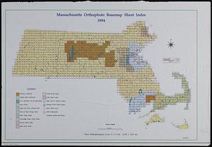
Massachusetts orthophoto basemap sheet index
173.
Massachusetts orthophoto basemap sheet index
174.
Massachusetts, Rhode-Island and Connecticut
175.
Massachusetts tourists map : showing tourways, picnic sites, beaches, and camp grounds
176.
Massachusetts Turnpike map : the main street of Massachusetts
177.
Massachusetts, we have a special place for you
178.
Massachusetts with Connecticut and Rhode Island
179.
The Matthews-Northrup up-to-date map of Massachusetts
180.
Motor routes that intersect the Bay Circuit
‹ Prev
Next ›
1
2
…
5
6
7
8
9
10
11
12
13
…
15
16