Toggle navigation
LMEC Home
Exhibitions
Georeferencing
Tools for Teachers
Collections
My Favorites
Sign Up / Log In
Search
Search the map portal
Map Collection
Map Collection
Map Sets
Search
Search
Search for
Search In
All Fields
Creator
Title
Subject
Place
Search All Digital Collections
Advanced Search
8178 Results
My Search
Start Over
More Like
commonwealth:6t053q240
Remove constraint More Like: commonwealth:6t053q240
Filter your Search
Place
North and Central America
4,927
United States
3,606
Suffolk (county)
1,026
Boston
999
Europe
963
Canada
429
France
269
Massachusetts
249
more
Place
»
Topic
Boston (Mass.)--Maps
574
United States--Maps
270
Real property--Massachusetts--Boston--Maps
174
Massachusetts--Maps
160
Landowners--Massachusetts--Boston--Maps
132
North America--Maps--Early works to 1800
104
New England--Maps
99
Europe--Maps
78
more
Topic
»
Date
Date range begin
–
Date range end
Current results range from
1482
to
2023
View distribution
Creator
United States. Hydrographic Office
357
O.H. Bailey & Co
148
Des Barres, Joseph F. W. (Joseph Frederick Wallet), 1722-1824
123
United States. Post Office Dept
120
Ptolemy, 2nd cent
100
Walling, Henry Francis, 1825-1888
94
Jefferys, Thomas, -1771
85
Geological Survey (U.S.)
82
more
Creator
»
Format
Maps/Atlases
8,119
Manuscripts
215
Prints
51
Books
36
Objects/Artifacts
10
Drawings/Illustrations
8
Posters
4
Georeferenced
Yes
871
No
7,307
Collection
Norman B. Leventhal Map Center Collection
8,164
Boston and New England Maps
2,184
Urban Maps
1,925
Maritime Charts and Atlases
750
American Revolutionary War-Era Maps
627
Boston Redevelopment Authority Collection
86
New York Public Library Collection
8
Richard H. Brown Revolutionary War Map Collection at Mount Vernon
4
more
Collection
»
Available to use
No known restrictions
8,021
Creative Commons license
60
Search Constraints
Sort by relevance
relevance
title
date (asc)
date (desc)
Number of results to display per page
10 per page
10
per page
20
per page
50
per page
100
per page
View results as:
grid view
map view
Search Results
1.
Carte de la Nouvelle York, y-compris les terres cédées du N. Hamp-Shire, sous le nom d'etat de Vermont
2.
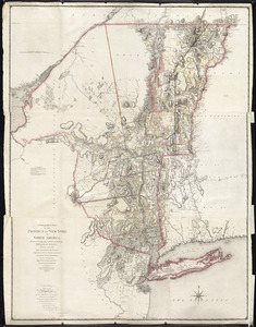
A chorographical map of the Province of New-York in North America, divided into counties, manors, patents and townships :...
3.
A chorographical map of the Province of New-York in North America, divided into counties, manors, patents and townships :...
4.
Karte von Neu England, Neu Yorck und Pensilvanien : sur Allgemeinen historie der reisen
5.
A map of the inhabited part of Canada from the French surveys : with the frontiers of New York and New England from the large...
6.
A map of the provinces of New-York and New Jersey, with a part of Pennsylvania and the Province of Quebec
7.
New Engelland, New York, New Yersey und Pensilvania
8.
Pas caert van Nieu Nederland, Virginia en Nieu Engelant
9.
Pensylvania Nova Jersey et Nova York cum Regionibus ad Fluvium Delaware in America sitis
10.
The southern part of the Province of New York : with part of the adjoining colonies
‹ Prev
Next ›
1
2
3
4
5
…
817
818