Toggle navigation
LMEC Home
Exhibitions
Georeferencing
Tools for Teachers
Collections
My Favorites
Sign Up / Log In
Search
Search the map portal
Map Collection
Map Collection
Map Sets
Search
Search
Search for
Search In
All Fields
Creator
Title
Subject
Place
Search All Digital Collections
Advanced Search
8655 Results
My Search
Start Over
More Like
commonwealth:6t053p82p
Remove constraint More Like: commonwealth:6t053p82p
Filter your Search
Place
North and Central America
5,894
United States
4,809
Massachusetts
2,071
Europe
1,392
Suffolk (county)
1,041
Boston
1,014
Canada
449
Asia
437
more
Place
»
Topic
Boston (Mass.)--Maps
582
United States--Maps
279
Real property--Massachusetts--Boston--Maps
175
Massachusetts--Maps
161
Landowners--Massachusetts--Boston--Maps
133
North America--Maps--Early works to 1800
103
New England--Maps
101
Europe--Maps
79
more
Topic
»
Date
Date range begin
–
Date range end
Current results range from
1482
to
2023
View distribution
Creator
United States. Hydrographic Office
595
O.H. Bailey & Co
148
Des Barres, Joseph F. W. (Joseph Frederick Wallet), 1722-1824
123
United States. Post Office Dept
120
Ptolemy, 2nd cent
100
Walling, Henry Francis, 1825-1888
94
Geological Survey (U.S.)
86
Jefferys, Thomas, -1771
85
more
Creator
»
Format
Maps/Atlases
8,595
Manuscripts
215
Prints
56
Books
36
Objects/Artifacts
10
Drawings/Illustrations
8
Posters
5
Georeferenced
Yes
870
No
7,785
Collection
Norman B. Leventhal Map & Education Center Collection
8,646
Boston and New England Maps
2,220
Urban Maps
1,992
Maritime Charts and Atlases
1,083
American Revolutionary War-Era Maps
623
Boston Redevelopment Authority Collection
87
Sidney R. Knafel Map Collection at Phillips Academy
5
Richard H. Brown Revolutionary War Map Collection at Mount Vernon
3
more
Collection
»
Available to use
No known restrictions
8,504
Creative Commons license
50
Search Constraints
Sort by relevance
relevance
title
date (asc)
date (desc)
Number of results to display per page
20 per page
10
per page
20
per page
50
per page
100
per page
View results as:
grid view
map view
Search Results
1.
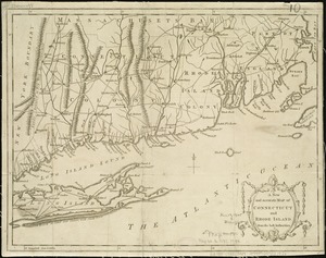
An accurate map of Rhode Island, part of Connecticut and Massachusets, shewing Admiral Arbuthnot's station in blocking up...
2.
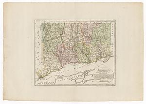
Connecticut
3.
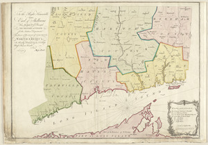
A map of the colonies of Connecticut and Rhode Island, divided into counties & townships, from the best authorities
4.
A map of the colony of Rhode Island : with the adjacent parts of Connecticut, Massachusetts Bay, &c
5.
A map of the province of Massachusets Bay and colony of Rhode Island, with part of Connecticut, New Hampshire, and Vermont
6.
A new and accurate map of Connecticut and Rhode Island, from the best authorities
7.
A new and accurate map of the colony of Massachusets Bay, in North America, from a late survey
8.
An accurate map of Rhode Island, part of Connecticut and Massachusets, shewing Admiral Arbuthnot's station in blocking up...
9.
Connecticut
10.
Connecticut and parts adjacent
11.
Connecticut and parts adjacent
12.
A map of the province of Massachusets Bay and colony of Rhode Island, with part of Connecticut, New Hampshire, and Vermont
13.
A new and accurate map of the colony of Massachusets Bay, in North America, from a late survey
14.
A new and accurate map of the present seat of war in North America : from a late survey
15.
Part of east New Jarsey, New York, and Connecticut
16.
To the right honourable, the Earl of Shelbourne, His Majesty's principal Secretary of State for the Southern Department : this...
17.
The 100th anniversary map of Abraham Lincoln's visit to Massachusetts, September 11-23, 1848
18.
1630 shoreline
19.
1879. Progress map of the U.S. Geographical Surveys west of the 100th Meridian : prepared under the direction of 1st Lieut....
20.
1903 Map of Salem and surrounding places
‹ Prev
Next ›
1
2
3
4
5
…
432
433