Toggle navigation
LMEC Home
Exhibitions
Georeferencing
Tools for Teachers
Collections
My Favorites
Sign Up / Log In
Search
Search the map portal
Map Collection
Map Collection
Map Sets
Search
Search
Search for
Search In
All Fields
Creator
Title
Subject
Place
Search All Digital Collections
Advanced Search
8662 Results
My Search
Start Over
More Like
commonwealth:6h446v76r
Remove constraint More Like: commonwealth:6h446v76r
Filter your Search
Place
North and Central America
5,957
United States
4,881
Massachusetts
2,062
Europe
1,359
Suffolk (county)
1,146
Boston
1,119
Canada
448
Asia
422
more
Place
»
Topic
Boston (Mass.)--Maps
598
United States--Maps
273
Real property--Massachusetts--Boston--Maps
252
Landowners--Massachusetts--Boston--Maps
169
Massachusetts--Maps
160
City planning--Massachusetts--Boston--Maps
138
North America--Maps--Early works to 1800
103
New England--Maps
99
more
Topic
»
Date
Date range begin
–
Date range end
Current results range from
1482
to
2023
View distribution
Creator
United States. Hydrographic Office
594
O.H. Bailey & Co
148
Boston Redevelopment Authority
140
Des Barres, Joseph F. W. (Joseph Frederick Wallet), 1722-1824
123
United States. Post Office Dept
120
Ptolemy, 2nd cent
100
Walling, Henry Francis, 1825-1888
94
Geological Survey (U.S.)
86
more
Creator
»
Format
Maps/Atlases
8,603
Manuscripts
215
Prints
56
Books
36
Objects/Artifacts
10
Drawings/Illustrations
8
Posters
4
Georeferenced
Yes
870
No
7,792
Collection
Norman B. Leventhal Map & Education Center Collection
8,551
Boston and New England Maps
2,281
Urban Maps
2,013
Maritime Charts and Atlases
1,081
American Revolutionary War-Era Maps
616
Boston Redevelopment Authority Collection
163
Massachusetts Real Estate Atlases
35
Mapping Boston Collection
1
Available to use
No known restrictions
8,485
Creative Commons license
47
Search Constraints
Sort by date (asc)
relevance
title
date (asc)
date (desc)
Number of results to display per page
20 per page
10
per page
20
per page
50
per page
100
per page
View results as:
grid view
map view
Search Results
8261.
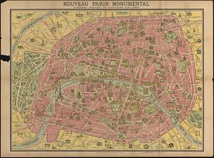
Nouveau Paris monumental : itinéraire pratique de l'etranger dans Paris
8262.
The pictorial map, a world of stamps
8263.
The pictorial map, stamps of America
8264.
The pictorial map, stamps of the U.S.A.
8265.
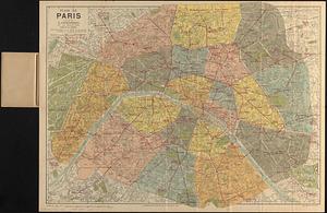
Plan de Paris divisé en 20 arrondissements et 80 quartiers
8266.
The 100th anniversary map of Abraham Lincoln's visit to Massachusetts, September 11-23, 1848
8267.
Ask Shell!
8268.
The Boston Globe ski map of northern New England and Canada
8269.
Election map of the United States with 49 novel diagrams
8270.
Map of the island of Tangerina and Wild Island
8271.
Metropolitan Transit Authority system route map
8272.
Atlas of town of Weymouth Massachusetts
8273.
Gay days around America : a pleasure map of festivals, pageants, and special events best reached by Greyhound ... the...
8274.
A map of the West Indies and the Spanish Main
8275.
The pictorial map, United States stamps
8276.
Storrow Memorial Embankment : plan of additions and changes under the requirements of Chapter 262, Acts of 1949
8277.
A Texan's map of the United States [of Texas]
8278.
These United States : products & industries
8279.
United States inlay puzzle
8280.
Armour food source map
‹ Prev
Next ›
1
2
…
410
411
412
413
414
415
416
417
418
…
433
434


![A Texan's map of the United States [of Texas]](https://bpldcassets.blob.core.windows.net/derivatives/images/commonwealth:fn107c388/image_thumbnail_300.jpg)


