Toggle navigation
LMEC Home
Exhibitions
Georeferencing
Tools for Teachers
Collections
My Favorites
Sign Up / Log In
Search
Search the map portal
Map Collection
Map Collection
Map Sets
Search
Search
Search for
Search In
All Fields
Creator
Title
Subject
Place
Search All Digital Collections
Advanced Search
8747 Results
My Search
Start Over
More Like
commonwealth:6h446r942
Remove constraint More Like: commonwealth:6h446r942
Filter your Search
Place
North and Central America
5,987
United States
4,907
Massachusetts
2,080
Europe
1,392
Suffolk (county)
1,143
Boston
1,116
Canada
449
Asia
436
more
Place
»
Topic
Boston (Mass.)--Maps
603
United States--Maps
279
Real property--Massachusetts--Boston--Maps
254
Landowners--Massachusetts--Boston--Maps
170
Massachusetts--Maps
161
City planning--Massachusetts--Boston--Maps
127
North America--Maps--Early works to 1800
102
New England--Maps
101
more
Topic
»
Date
Date range begin
–
Date range end
Current results range from
1482
to
2023
View distribution
Creator
United States. Hydrographic Office
595
O.H. Bailey & Co
148
Boston Redevelopment Authority
131
Des Barres, Joseph F. W. (Joseph Frederick Wallet), 1722-1824
123
United States. Post Office Dept
120
Ptolemy, 2nd cent
100
Walling, Henry Francis, 1825-1888
94
Geological Survey (U.S.)
86
more
Creator
»
Format
Maps/Atlases
8,687
Manuscripts
215
Prints
56
Books
36
Objects/Artifacts
10
Drawings/Illustrations
8
Posters
5
Georeferenced
Yes
870
No
7,877
Collection
Norman B. Leventhal Map & Education Center Collection
8,648
Boston and New England Maps
2,288
Urban Maps
2,057
Maritime Charts and Atlases
1,083
American Revolutionary War-Era Maps
614
Boston Redevelopment Authority Collection
151
Massachusetts Real Estate Atlases
35
Applied Geographics, Inc. Records
2
more
Collection
»
Available to use
No known restrictions
8,569
Creative Commons license
48
Search Constraints
Sort by relevance
relevance
title
date (asc)
date (desc)
Number of results to display per page
20 per page
10
per page
20
per page
50
per page
100
per page
View results as:
grid view
map view
Search Results
5921.
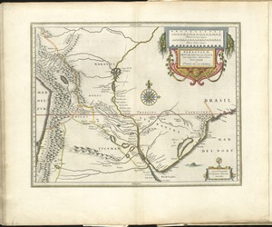
Paraguay, ó, prov. de Rio de la Plata cum regionibus adiacentibus Tucuman et Sta. Cruz de la Sierra
5922.
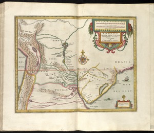
Paraguay, ó prov. de Rio de la Plata cum regionibus adiacentibus Tucuman et Sta. Cruz de la Sierra
5923.
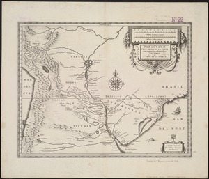
Paraguay, ó prov. de Rio de la Plata cum regionibus adiacentibus Tucuman et Sta. Cruz de la Sierra
5924.
Le Paraguayr, Le Chili, La Terre, et les Isles Magellanicques : tirées de diverses rélations
5925.
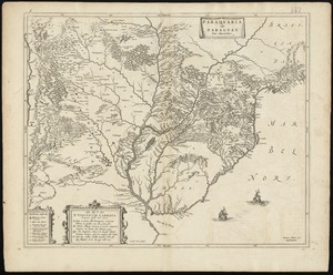
Paraquaria vulgo Paraguay : cum adjacentibus
5926.
Parcel 13 rehabilitation
5927.
Parcel 22
5928.
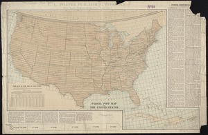
Parcel post map of the United States
5929.
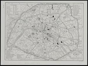
Paris
5930.
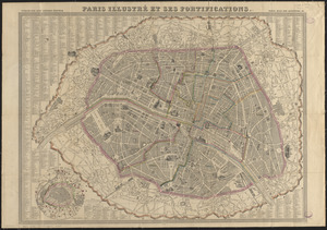
Paris illustré et ses fortifications
5931.
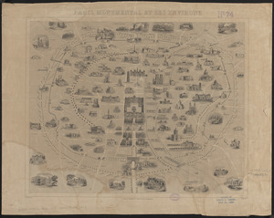
Paris monumental et ses environs
5932.
Parkersburg, West Va
5933.
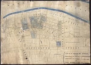
Part of an estate in Lowell, the property of Sarah C. Livermore
5934.
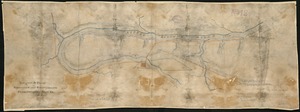
Part of New England
5935.
Part of New York City
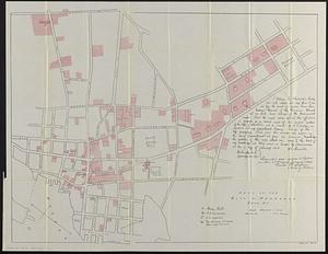
5936.
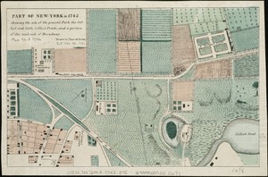
Part of New York in 1742 : showing the site of the present park, the collect and the little collect ponds, and a portion of the...
5937.
Part of the city of Honolulu, Oahu H.I.
5938.
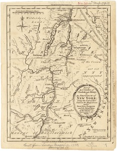
Part of the counties of Charlotte and Albany, in the Province of New York : being the seat of war between the King's forces...
5939.
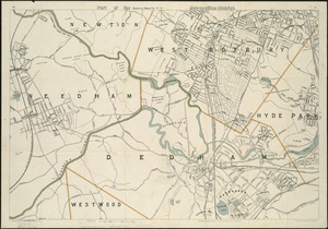
Part of the metropolitan district
5940.
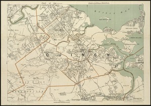
Part of the (Quincy) metropolitan district
‹ Prev
Next ›
1
2
…
293
294
295
296
297
298
299
300
301
…
437
438