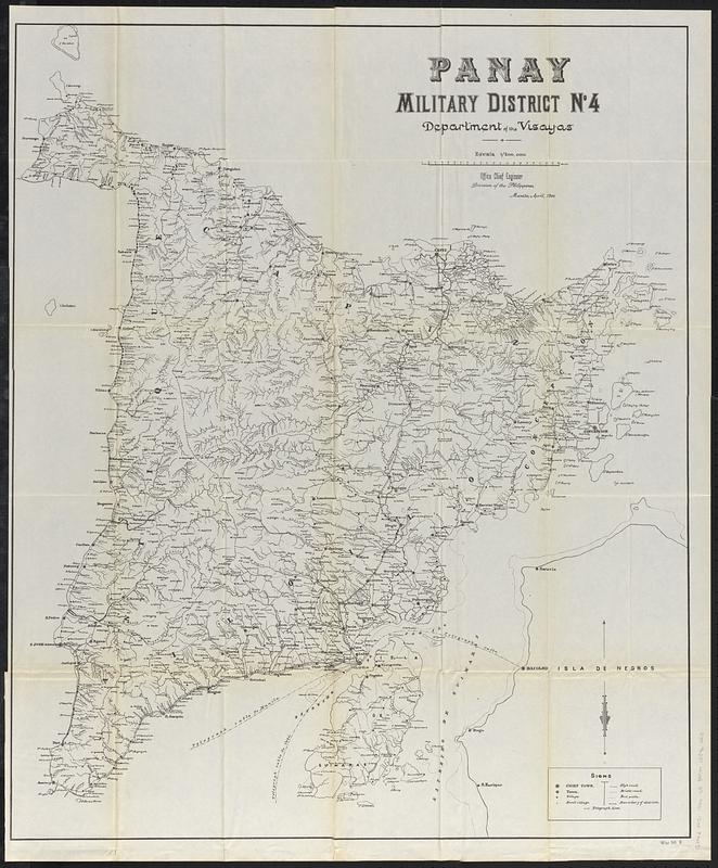
Panay, military district no 4, Department of the Visayas
Item Information
- Title:
- Panay, military district no 4, Department of the Visayas
- Description:
-
U.S. military map of the island of Panay showing place names, roads, paths, and district boundaries.
- Cartographer:
- United States. Army. Division of the Philippines. Engineer Office
- Name on Item:
-
Office Chief Engineer, Division of the Philippines, Manila, April, 1900
- Date:
-
[1900]
- Format:
-
Maps/Atlases
- Location:
-
Boston Public Library
Norman B. Leventhal Map & Education Center - Collection (local):
-
Norman B. Leventhal Map & Education Center Collection
- Subjects:
-
Philippines--History--Philippine American War, 1899-1902--Maps
Panay Island (Philippines)--Maps
United States. Army. Department of the Visayas
- Places:
-
PhilippinesPanay (island)
- Extent:
- 1 map ; 98 x 81 cm
- Terms of Use:
-
No known copyright restrictions.
No known restrictions on use.
- Publisher:
-
[Washington, D.C.] :
[Government Printing Office]
- Scale:
-
Scale 1:200,000
- Language:
-
English
Spanish
- Notes:
-
Relief shown by spot heights.
From Annual reports of the War Department for the fiscal year ended June 30, 1900. Report of the Lieutenant General commanding the army (Washington : Government Printing Office, 1900).
"War 56 2."
- Notes (date):
-
This date is inferred.
- Notes (language):
-
Map mainly in English. Scale and some features in Spanish.
- Identifier:
-
06_01_018382
- Call #:
-
G8062.P4S1 1900 .U5
- Barcode:
-
39999085966818