Toggle navigation
LMEC Home
Exhibitions
Georeferencing
Tools for Teachers
Collections
My Favorites
Sign Up / Log In
Search
Search the map portal
Map Collection
Map Collection
Map Sets
Search
Search
Search for
Search In
All Fields
Creator
Title
Subject
Place
Search All Digital Collections
Advanced Search
8888 Results
My Search
Start Over
More Like
commonwealth:69701g66q
Remove constraint More Like: commonwealth:69701g66q
Filter your Search
Place
North and Central America
6,119
United States
5,035
Massachusetts
2,143
Europe
1,396
Suffolk (county)
1,234
Boston
1,207
Canada
449
Asia
438
more
Place
»
Topic
Boston (Mass.)--Maps
752
United States--Maps
282
Real property--Massachusetts--Boston--Maps
195
City planning--Massachusetts--Boston--Maps
182
Massachusetts--Maps
166
Landowners--Massachusetts--Boston--Maps
142
New England--Maps
104
North America--Maps--Early works to 1800
103
more
Topic
»
Date
Date range begin
–
Date range end
Current results range from
1482
to
2023
View distribution
Creator
United States. Hydrographic Office
595
Boston Redevelopment Authority
186
O.H. Bailey & Co
148
Des Barres, Joseph F. W. (Joseph Frederick Wallet), 1722-1824
124
United States. Post Office Dept
120
Ptolemy, 2nd cent
100
Walling, Henry Francis, 1825-1888
94
Geological Survey (U.S.)
87
more
Creator
»
Format
Maps/Atlases
8,828
Manuscripts
215
Prints
56
Books
36
Objects/Artifacts
10
Drawings/Illustrations
8
Posters
5
Georeferenced
Yes
886
No
8,002
Collection
Norman B. Leventhal Map & Education Center Collection
8,723
Boston and New England Maps
2,384
Urban Maps
2,168
Maritime Charts and Atlases
1,083
American Revolutionary War-Era Maps
638
Boston Redevelopment Authority Collection
218
Mapping Boston Collection
20
Massachusetts Real Estate Atlases
12
more
Collection
»
Available to use
No known restrictions
8,691
Creative Commons license
70
Search Constraints
Sort by relevance
relevance
title
date (asc)
date (desc)
Number of results to display per page
20 per page
10
per page
20
per page
50
per page
100
per page
View results as:
grid view
map view
Search Results
4981.
Map of West Roxbury
4982.
Map of West Virginia showing coal, oil, gas and limestone areas
4983.
Map of West Virginia showing railroads and county products
4984.
A map of Westborough
4985.
Map of Westborough Mass
4986.
Map of White Pass & Yukon Route and connections
4987.
Map of Whitley County
4988.
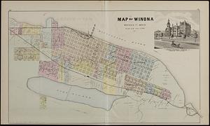
Map of Winona, Winona Co., Minn. : T.107.N.R.7.W. of 5th P.M.
4989.
Map of Wisconsin showing geology and roads
4990.
Map of Wiskonsin Territory, compiled from the public surveys
4991.
Map of Woods County, West Virginia
4992.
Map of Woodstock, Conn
4993.
Map of Worcester County, Mass
4994.
Map of Worcester County, Massachusetts : based upon the trigonometrical survey of the state
4995.
Map of Worcester County, Massachusetts
4996.
Map of Worcester Mass
4997.
Map of Yakima Region, Washington, Ter.
4998.
A map or plot of the twenty-five divisions of land ... late in the Township of Dorchester and now in the Township of Stoughton,...
4999.
Map railway route, Seward to Fairbanks : (including Matanuska - branch)
5000.
Map second division railway mail service
‹ Prev
Next ›
1
2
…
246
247
248
249
250
251
252
253
254
…
444
445