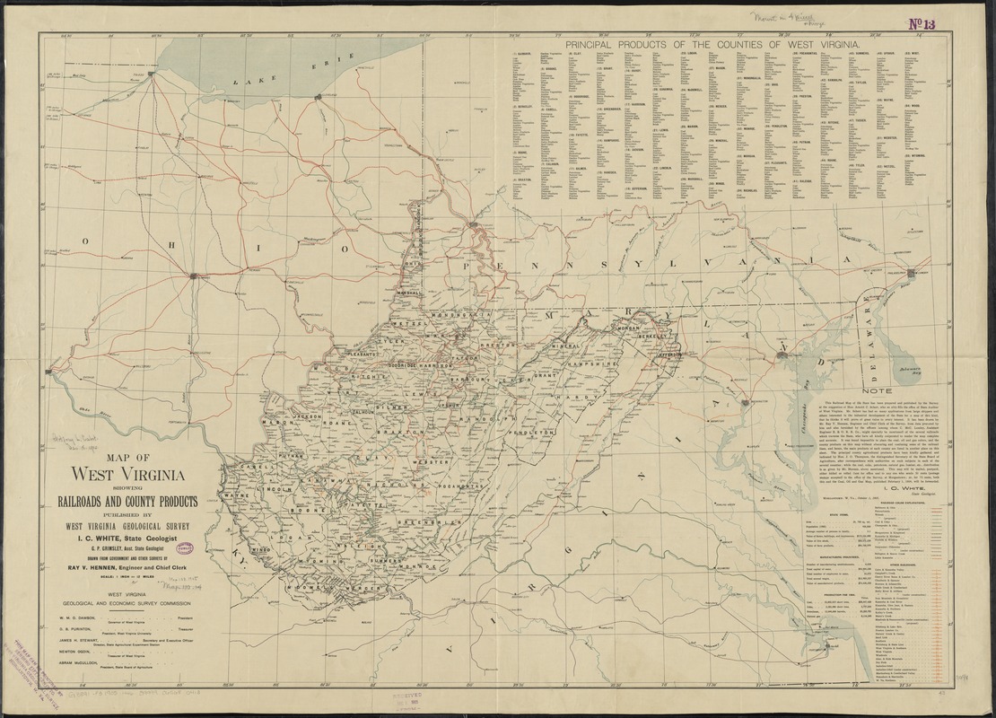
Map of West Virginia showing railroads and county products
Item Information
- Title:
- Map of West Virginia showing railroads and county products
- Creator:
- Hennen, Ray V. (Ray Vernon)
- Name on Item:
-
drawn from government and other surveys by Ray V. Hennen, engineer and chief clerk.
- Date:
-
1905
- Format:
-
Maps/Atlases
- Location:
-
Boston Public Library
Norman B. Leventhal Map & Education Center - Collection (local):
-
Norman B. Leventhal Map & Education Center Collection
- Subjects:
-
Railroads--West Virginia--Maps
Produce trade--West Virginia--Maps
Mines and mineral resources--West Virginia--Maps
Manufactures--West Virginia--Maps
West Virginia--Administrative and political divisions--Maps
- Places:
-
West Virginia
- Extent:
- 1 map : col. ; 79 x 110 cm.
- Terms of Use:
-
No known copyright restrictions.
No known restrictions on use.
- Publisher:
-
Morgantown :
West Virginia Geological Survey
- Scale:
-
Scale [1:760,320]. 1 in. = 12 miles
- Language:
-
English
- Notes:
-
Covers West Virginia and the surrounding states.
Indexed for "Other railroads."
"I.C. White, State Geologist. Morgantown, W. Va., October 1, 1905."
Includes text, indexed list of the "Principal products of the counties of West Virginia," basic census information, statewide production totals for coal, coke, petroleum, natural gas, and manufacturing industries for 1904, and table of Geological and Economic Survey commissioners.
- Identifier:
-
06_01_011017
- Call #:
-
G3891.P3 1905 .H46
- Barcode:
-
39999065680413