Toggle navigation
LMEC Home
Exhibitions
Georeferencing
Tools for Teachers
Collections
My Favorites
Sign Up / Log In
Search
Search the map portal
Map Collection
Map Collection
Map Sets
Search
Search
Search for
Search In
All Fields
Creator
Title
Subject
Place
Search All Digital Collections
Advanced Search
8695 Results
My Search
Start Over
More Like
commonwealth:4m90fm44b
Remove constraint More Like: commonwealth:4m90fm44b
Filter your Search
Place
North and Central America
5,926
United States
4,844
Massachusetts
2,079
Europe
1,396
Suffolk (county)
1,046
Boston
1,019
Canada
449
Asia
439
more
Place
»
Topic
Boston (Mass.)--Maps
586
United States--Maps
282
Real property--Massachusetts--Boston--Maps
175
Massachusetts--Maps
162
Landowners--Massachusetts--Boston--Maps
133
North America--Maps--Early works to 1800
103
New England--Maps
102
Europe--Maps
79
more
Topic
»
Date
Date range begin
–
Date range end
Current results range from
1482
to
2023
View distribution
Creator
United States. Hydrographic Office
595
O.H. Bailey & Co
148
Des Barres, Joseph F. W. (Joseph Frederick Wallet), 1722-1824
123
United States. Post Office Dept
120
Ptolemy, 2nd cent
100
Walling, Henry Francis, 1825-1888
94
Geological Survey (U.S.)
86
Jefferys, Thomas, -1771
85
more
Creator
»
Format
Maps/Atlases
8,635
Manuscripts
215
Prints
56
Books
36
Objects/Artifacts
10
Drawings/Illustrations
8
Posters
5
Georeferenced
Yes
868
No
7,827
Collection
Norman B. Leventhal Map & Education Center Collection
8,694
Boston and New England Maps
2,233
Urban Maps
2,023
Maritime Charts and Atlases
1,083
American Revolutionary War-Era Maps
616
Boston Redevelopment Authority Collection
87
Sidney R. Knafel Map Collection at Phillips Academy
1
Available to use
No known restrictions
8,552
Creative Commons license
47
Search Constraints
Sort by relevance
relevance
title
date (asc)
date (desc)
Number of results to display per page
20 per page
10
per page
20
per page
50
per page
100
per page
View results as:
grid view
map view
Search Results
61.
Philips' map of the seat of war shewing the country from Paris to Berlin, with the Rhine Provinces on a large scale
62.
Philips' new commercial map of Europe
63.
Philips' new map of Central Europe
64.
Photo relief map of Europe
65.
Physiographic diagram of Europe
66.
Political map of Europe
67.
The races of Europe
68.
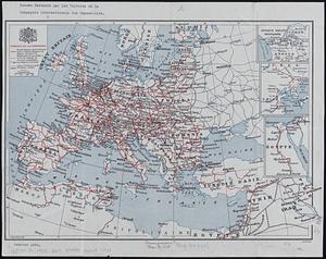
Reseau parcouru par les voitures de la Compagnie Internationale des Wagons-lits
69.
Saishin ōshū daichizu
70.
Serio-comic war map for the year 1877
71.
Shepherd's map of the seat of war
72.
Stanford's enlarged map of the seat of war
73.
Stanford's shilling map of the seat of war
74.
Strategic map of Central Europe showing the international frontiers
75.
The travellers; or, a tour through Europe
76.
Verkehrs-karte von Europa : übersichts grösserer eisenbahnverbindungen, telegraphen und überseeischer dampfschiffahrt
77.
The victory war map
78.
A vision of Private Kutschkes of the German National Guard = Traumgebild des deutschen Landwehrmanns Kutschke!
79.
Generale Ptholemei
80.
The 100th anniversary map of Abraham Lincoln's visit to Massachusetts, September 11-23, 1848
‹ Prev
Next ›
1
2
3
4
5
6
7
8
…
434
435