Toggle navigation
LMEC Home
Exhibitions
Georeferencing
Tools for Teachers
Collections
My Favorites
Sign Up / Log In
Search
Search the map portal
Map Collection
Map Collection
Map Sets
Search
Search
Search for
Search In
All Fields
Creator
Title
Subject
Place
Search All Digital Collections
Advanced Search
8577 Results
My Search
Start Over
More Like
commonwealth:4m90fk533
Remove constraint More Like: commonwealth:4m90fk533
Filter your Search
Place
North and Central America
5,851
United States
4,769
Massachusetts
2,052
Europe
1,359
Suffolk (county)
1,034
Boston
1,007
Canada
448
Asia
422
more
Place
»
Topic
Boston (Mass.)--Maps
577
United States--Maps
273
Real property--Massachusetts--Boston--Maps
174
Massachusetts--Maps
160
Landowners--Massachusetts--Boston--Maps
132
North America--Maps--Early works to 1800
103
New England--Maps
99
Europe--Maps
78
more
Topic
»
Date
Date range begin
–
Date range end
Current results range from
1482
to
2023
View distribution
Creator
United States. Hydrographic Office
594
O.H. Bailey & Co
148
Des Barres, Joseph F. W. (Joseph Frederick Wallet), 1722-1824
123
United States. Post Office Dept
120
Ptolemy, 2nd cent
100
Walling, Henry Francis, 1825-1888
94
Geological Survey (U.S.)
86
Jefferys, Thomas, -1771
86
more
Creator
»
Format
Maps/Atlases
8,518
Manuscripts
216
Prints
56
Books
36
Objects/Artifacts
10
Drawings/Illustrations
8
Posters
4
Georeferenced
Yes
873
No
7,704
Collection
Norman B. Leventhal Map & Education Center Collection
8,550
Boston and New England Maps
2,204
Urban Maps
1,936
Maritime Charts and Atlases
1,082
American Revolutionary War-Era Maps
642
Boston Redevelopment Authority Collection
87
American Antiquarian Society Collection
18
William L. Clements Library Collection
8
more
Collection
»
Available to use
No known restrictions
8,409
Creative Commons license
46
Search Constraints
Sort by relevance
relevance
title
date (asc)
date (desc)
Number of results to display per page
20 per page
10
per page
20
per page
50
per page
100
per page
View results as:
grid view
map view
Search Results
21.
West Indies
22.
The West Indies, and Gulf of Mexico, : from the latest discoveries and best observations
23.
Carte geo-hydrographique du Golfe du Mexique et de ces isles : construit d'après les mémoires les plus recens, et assujeties...
24.
West Indies, south coast of Cuba, Port Guantanamo, or Cumberland Harbor : from a Spanish government survey corrected to 1881
25.
Dagbladets kart over krigsskuepladsen
26.
Nord-u. Mittel-Amerika
27.
North America, east coast of Central America, Cape Gracias á Dios to Gulf of Darien : compiled from the latest British surveys...
28.
North America, west coast of Central America, Ocos River to San Juan del Sur
29.
Spanish North America, southern part
30.
Carta general de la República Mexicana conforme a últimos datos
31.
Carta geografica general de la republica Mexicana
32.
Carte du Mexique
33.
Carte du Mexique et des pays limitrophes situés au nord et à l'est : dressée d'après la grande carte de la Nouvelle Espagne...
34.
Carte générale du royaume de la Nouvelle Espagne depuis le parallèle de 16° jusqu'au parallèle de 38° (latitude nord)
35.
A correct map of the seat of war in Mexico : being a copy of Genl. Arista's map, taken at Resaca de la Palma, with additions...
36.
General railway map engraved expressly for the Official guide of the railways and steam navigation lines of the United States,...
37.
Map of Mexico, constructed from all available materials and corrected to 1862 = H. Kiepert's karte von Mexico, überdruck aus...
38.
Map of the Mexican National Railway : showing also its relative position to the railway system of the United States, both as to...
39.
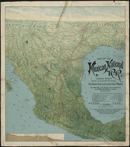
Map of the Mexican National R.R "Laredo route " and connections : the scenic short line to the city of Mexico
40.
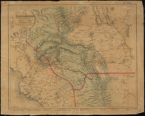
Map of the Texas, Topolobampo and Pacific Railroad and Telegraph Cpy. (Western Division) : from Chihuahua and Parral to...
‹ Prev
Next ›
1
2
3
4
5
6
…
428
429