Toggle navigation
LMEC Home
Exhibitions
Georeferencing
Tools for Teachers
Collections
My Favorites
Sign Up / Log In
Search
Search the map portal
Map Collection
Map Collection
Map Sets
Search
Search
Search for
Search In
All Fields
Creator
Title
Subject
Place
Search All Digital Collections
Advanced Search
8802 Results
My Search
Start Over
More Like
commonwealth:4m90f418t
Remove constraint More Like: commonwealth:4m90f418t
Filter your Search
Place
North and Central America
6,033
United States
4,930
Massachusetts
2,152
Europe
1,396
Suffolk (county)
1,049
Boston
1,022
Canada
456
Asia
438
more
Place
»
Topic
Boston (Mass.)--Maps
592
United States--Maps
282
Massachusetts--Maps
235
Real property--Massachusetts--Boston--Maps
175
Landowners--Massachusetts--Boston--Maps
133
New England--Maps
127
North America--Maps--Early works to 1800
103
Europe--Maps
79
more
Topic
»
Date
Date range begin
–
Date range end
Current results range from
1482
to
2023
View distribution
Creator
United States. Hydrographic Office
595
O.H. Bailey & Co
148
Des Barres, Joseph F. W. (Joseph Frederick Wallet), 1722-1824
123
United States. Post Office Dept
120
Ptolemy, 2nd cent
100
Walling, Henry Francis, 1825-1888
95
Geological Survey (U.S.)
93
Jefferys, Thomas, -1771
86
more
Creator
»
Format
Maps/Atlases
8,741
Manuscripts
217
Prints
56
Books
36
Objects/Artifacts
10
Drawings/Illustrations
8
Posters
5
Ephemera
1
Georeferenced
Yes
881
No
7,921
Collection
Norman B. Leventhal Map & Education Center Collection
8,742
Boston and New England Maps
2,286
Urban Maps
2,024
Maritime Charts and Atlases
1,083
American Revolutionary War-Era Maps
660
Boston Redevelopment Authority Collection
90
David Judkins Weaver Papers
23
Applied Geographics, Inc. Records
20
more
Collection
»
Available to use
No known restrictions
8,600
Creative Commons license
54
Search Constraints
Sort by relevance
relevance
title
date (asc)
date (desc)
Number of results to display per page
20 per page
10
per page
20
per page
50
per page
100
per page
View results as:
grid view
map view
Search Results
1801.
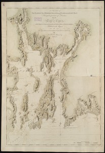
[Chart of the coast of Quebec from the Riviere St. Jean to Grand Hermine Bay]
1802.
A chart of the discoveries made by the late Capt. Cook, & other European navigators, in the great Pacific Ocean between Asia...
1803.
Chart of the east coast of Madagascar, including the Mauritius, Seychelle islands &c. between the latitudes of 2°30' & 26°30'...
1804.
Chart of the entrance of Hudson's River, from Sandy Hook to New York, with the banks, depths of water, sailing-marks, & ca
1805.
[Chart of the gulf and river of St. Lawrence]
1806.
A chart of the harbour of Boston
1807.
A chart of the harbour of Boston
1808.
A chart of the harbour of Boston
1809.
A chart of the Harbour of Boston, with the soundings, sailing-marks, and other directions
1810.
A chart of the harbour of Halifax in Nova Scotia : with Jebucto Bay and Cape Sambro also the islands, ledges of rocks, shoals &...
1811.
A chart of the harbour of Rhode Island and Narraganset Bay
1812.
A chart of the harbour of Rhode Island and Narraganset Bay
1813.
Chart of the harbours of Salem, Marblehead, Beverly and Manchester : from a survey taken in the years 1804, 5 & 6
1814.
Chart of the harbours of Salem, Marblehead, Beverly, and Manchester : from a survey taken in the years 1804, 5 & 6
1815.
A chart of the history of printing in Europe
1816.
A chart of the iland of Hispaniola : with the Windward passage from Iamaica betwene ye east end of Cuba & the west end of...
1817.
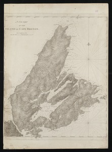
A chart of the island of Cape Breton
1818.
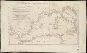
A chart of the Mediterranean Sea, with part of the Atlantic Ocean and Adriatic Sea, with the islands of Minorca, Majorca,...
1819.
Chart of the Mississippi River from the Ohio River to Gulf of Mexico : constructed and engraved to illustrate "The War with the...
1820.
A chart of the N.E. coast of Cape Breton Island, from St. Ann Bay to Cape Morien
‹ Prev
Next ›
1
2
…
87
88
89
90
91
92
93
94
95
…
440
441
![[Chart of the coast of Quebec from the Riviere St. Jean to Grand Hermine Bay]](https://bpldcassets.blob.core.windows.net/derivatives/images/commonwealth:7h149v50v/image_thumbnail_300.jpg)

![[Chart of the gulf and river of St. Lawrence]](https://bpldcassets.blob.core.windows.net/derivatives/images/commonwealth:7h149v39v/image_thumbnail_300.jpg)