Toggle navigation
LMEC Home
Exhibitions
Georeferencing
Tools for Teachers
Collections
My Favorites
Sign Up / Log In
Search
Search the map portal
Map Collection
Map Collection
Map Sets
Search
Search
Search for
Search In
All Fields
Creator
Title
Subject
Place
Search All Digital Collections
Advanced Search
8729 Results
My Search
Start Over
More Like
commonwealth:4m90f361w
Remove constraint More Like: commonwealth:4m90f361w
Filter your Search
Place
North and Central America
5,960
United States
4,878
Massachusetts
2,078
Europe
1,396
Suffolk (county)
1,046
Boston
1,019
Canada
450
Asia
438
more
Place
»
Topic
Boston (Mass.)--Maps
587
United States--Maps
282
Real property--Massachusetts--Boston--Maps
175
Massachusetts--Maps
162
Landowners--Massachusetts--Boston--Maps
133
North America--Maps--Early works to 1800
103
New England--Maps
102
Europe--Maps
79
more
Topic
»
Date
Date range begin
–
Date range end
Current results range from
1482
to
2023
View distribution
Creator
United States. Hydrographic Office
595
O.H. Bailey & Co
148
Des Barres, Joseph F. W. (Joseph Frederick Wallet), 1722-1824
123
United States. Post Office Dept
120
Ptolemy, 2nd cent
100
Walling, Henry Francis, 1825-1888
94
Geological Survey (U.S.)
86
Jefferys, Thomas, -1771
85
more
Creator
»
Format
Maps/Atlases
8,669
Manuscripts
217
Prints
56
Books
36
Objects/Artifacts
10
Drawings/Illustrations
8
Posters
5
Georeferenced
Yes
869
No
7,860
Collection
Norman B. Leventhal Map & Education Center Collection
8,693
Boston and New England Maps
2,232
Urban Maps
2,023
Maritime Charts and Atlases
1,083
American Revolutionary War-Era Maps
649
Boston Redevelopment Authority Collection
87
William L. Clements Library Collection
27
American Antiquarian Society Collection
4
more
Collection
»
Available to use
No known restrictions
8,554
Creative Commons license
48
Search Constraints
Sort by relevance
relevance
title
date (asc)
date (desc)
Number of results to display per page
20 per page
10
per page
20
per page
50
per page
100
per page
View results as:
grid view
map view
Search Results
61.
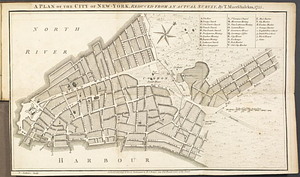
A Plan of the city of New York
62.
Plan of the city of New York in North America : surveyed in the years 1766 & 1767
63.
A plan of the city of New-York, reduced from an actual survey
64.
The provinces of New York, and New Jersey, : with part of Pensilvania [sic], and the province of Quebec
65.
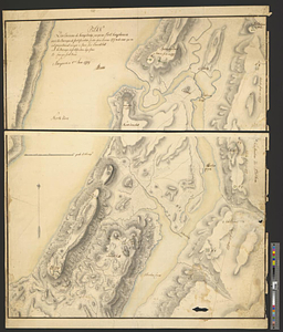
The seat of action, between the British and American forces or an authentic plan of the western part of Long Island, with the...
66.
Sketch of the country illustrating the late engagement in Long Island
67.
This plan of the City of New York (within the palisades which were erected in the year 1743) was made for the purpose of...
68.
Various plans and draughts of cities, towns, harbours &c. drawn from the latest authorities
69.
Ville de Manathe ou Nouvelle-Yorc
70.
British troop dispositions in and near New York City, Sept. 2d 1781
71.
Ye commencement for draft of New York Island
72.
The Delancey lands on Manhattan Island
73.
Disposition of the British forces on Long Island, Staten Island, and Manhattan Island, under Cornwallis and Knyphausen
74.
Isle de Newyork : reconnaissance des ouvrages du nord de lisle de Newyork faite en presence des Généraux, Wasington et...
75.
Kings Bridge
76.
Land holdings on Kip's Bay, Manhattan Island
77.
Map of New York I. with the adjacent rocks and other remarkable parts of Hell-Gate
78.
A map of the country adjacent to Kingsbridge, surveyed by order of his excellency General Sir Henry Clinton K.B., commander in...
79.
Part of the modern counties of Westchester and Bronx
80.
Plan des environs de Kingsbridge jusqu'au Fort Knyphausen avec les ouvrages de fortification faites dans l'année 1779 & de ceux...
‹ Prev
Next ›
1
2
3
4
5
6
7
8
…
436
437