Toggle navigation
LMEC Home
Exhibitions
Georeferencing
Tools for Teachers
Collections
My Favorites
Sign Up / Log In
Search
Search the map portal
Map Collection
Map Collection
Map Sets
Search
Search
Search for
Search In
All Fields
Creator
Title
Subject
Place
Search All Digital Collections
Advanced Search
8657 Results
My Search
Start Over
More Like
commonwealth:3t947b78d
Remove constraint More Like: commonwealth:3t947b78d
Filter your Search
Place
North and Central America
5,896
United States
4,811
Massachusetts
2,068
Europe
1,392
Suffolk (county)
1,041
Boston
1,014
Canada
449
Asia
437
more
Place
»
Topic
Boston (Mass.)--Maps
582
United States--Maps
279
Real property--Massachusetts--Boston--Maps
175
Massachusetts--Maps
161
Landowners--Massachusetts--Boston--Maps
133
North America--Maps--Early works to 1800
103
New England--Maps
101
Europe--Maps
79
more
Topic
»
Date
Date range begin
–
Date range end
Current results range from
1482
to
2023
View distribution
Creator
United States. Hydrographic Office
595
O.H. Bailey & Co
148
Des Barres, Joseph F. W. (Joseph Frederick Wallet), 1722-1824
123
United States. Post Office Dept
120
Ptolemy, 2nd cent
100
Walling, Henry Francis, 1825-1888
94
Geological Survey (U.S.)
86
Jefferys, Thomas, -1771
86
more
Creator
»
Format
Maps/Atlases
8,597
Manuscripts
215
Prints
56
Books
36
Objects/Artifacts
10
Drawings/Illustrations
8
Posters
5
Georeferenced
Yes
869
No
7,788
Collection
Norman B. Leventhal Map & Education Center Collection
8,646
Boston and New England Maps
2,221
Urban Maps
1,992
Maritime Charts and Atlases
1,083
American Revolutionary War-Era Maps
626
Boston Redevelopment Authority Collection
87
William L. Clements Library Collection
5
American Antiquarian Society Collection
4
more
Collection
»
Available to use
No known restrictions
8,504
Creative Commons license
48
Search Constraints
Sort by relevance
relevance
title
date (asc)
date (desc)
Number of results to display per page
20 per page
10
per page
20
per page
50
per page
100
per page
View results as:
grid view
map view
Search Results
1.
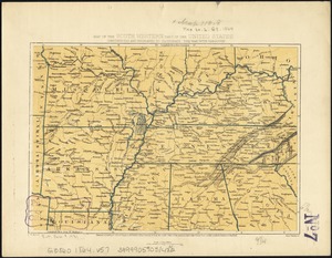
Colton's rail road and county map of the Southern States containing the latest information
2.
Johnson's new rail road & county copper plate map of the Southern States from the latest and best information
3.
Lloyd's map of the Southern States, showing all the railroads, their stations & distances : also the counties, towns, villages,...
4.
Lloyd's new military map of the border & southern states
5.
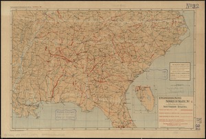
Map fourth division railway mail service
6.
Map of the south western part of the United States : constructed and engraved to illustrate "The War with the South"
7.
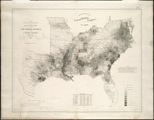
Map of the Southern States, showing the relative proportion of slaves in the different localities
8.
Map of Virginia and West Va., North and part of South Carolina, Maryland and Delaware, showing the situation in these states of...
9.
Map showing the distribution of the slave population of the southern states of the United States
10.
Map third division railway mail service
11.
Military map of the middle and southern states showing the seat of war during the great rebellion in 1861
12.
Perrine's new topographical war map of the southern states : taken from the latest government surveys and official reports
13.
Selected hurricanes affecting the southern United States 1954-1977
14.
Southeast States road map
15.
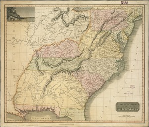
Southern provinces of the United States
16.
Southern States
17.
The United States southern part : from the latest surveys
18.
Where the fight will be centered, if there is one
19.
Carolinae Floridae nec non insularum Bahamensium : cum partibus adjacendibus delineatio ad Exemplar Londinense in lucem edita a...
20.
Carte de la Louisiane et de la Floride
‹ Prev
Next ›
1
2
3
4
5
…
432
433