Toggle navigation
LMEC Home
Exhibitions
Georeferencing
Tools for Teachers
Collections
My Favorites
Sign Up / Log In
Search
Search the map portal
Map Collection
Map Collection
Map Sets
Search
Search
Search for
Search In
All Fields
Creator
Title
Subject
Place
Search All Digital Collections
Advanced Search
396 Results
My Search
Start Over
More Like
commonwealth:3f462s67q
Remove constraint More Like: commonwealth:3f462s67q
Filter your Search
Place
North and Central America
319
North America
231
United States
143
Massachusetts
73
Boston
45
Suffolk (county)
44
New England
37
Canada
36
more
Place
»
Topic
North America--Maps--Early works to 1800
239
New England--Maps--Early works to 1800
29
Canada--Maps--Early works to 1800
24
Boston (Mass.)--Maps
20
Great Britain--Colonies--America--Maps--Early works to 1800
19
World maps--Early works to 1800
19
Great Lakes Region (North America)--Maps--Early works to 1800
17
Boston (Mass.)--History--Revolution, 1775-1783--Maps--Early works to 1800
16
more
Topic
»
Date
Date range begin
–
Date range end
Current results range from
1493
to
1927
View distribution
Creator
Mitchell, John, 1711-1768
18
Bellin, Jacques Nicolas, 1703-1772
16
Sayer, Robert, 1725-1794
15
Gibson, J. (John), active 1750-1792
14
Jefferys, Thomas, -1771
13
Moll, Herman, d. 1732
12
Anville, Jean Baptiste Bourguignon d', 1697-1782
11
Bowen, Emanuel, 1693 or 1694-1767
11
more
Creator
»
Format
Maps/Atlases
395
Manuscripts
3
Prints
1
Georeferenced
Yes
29
No
367
Collection
Norman B. Leventhal Map & Education Center Collection
252
American Revolutionary War-Era Maps
231
Mapping Boston Collection
141
Boston and New England Maps
76
MacLean Collection Map Library
71
New York Public Library Collection
33
Maritime Charts and Atlases
29
Urban Maps
24
more
Collection
»
Available to use
Creative Commons license
195
No known restrictions
118
Search Constraints
Sort by relevance
relevance
title
date (asc)
date (desc)
Number of results to display per page
20 per page
10
per page
20
per page
50
per page
100
per page
View results as:
grid view
map view
Search Results
1.
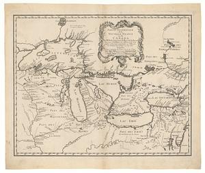
La Nuoua Francia
2.
Le Canada, ou Nouvelle France, &c : ce qui est le plus advance vers le Septentrion est tiré de diverses relations des Anglois,...
3.
Carte geographique de la Nouvelle Franse
4.
An accurate map of North America : describing and distinguishing the British and Spanish dominions on this great continent :...
5.
Carte tres curieuse de la Mer du Sud, contenant des remarques nouvelles et tres utiles non seulement sur les ports et iles de...
6.
A new map of the north parts of America claimed by France under ye names of Louisiana, Mississipi, Canada, and New France with...
7.
Norumbega et Virginia
8.
Noua Anglia, Nouum Belgium, et Virginia
9.
Nova tabula geographica complectens borealiorem Americæ partem : in qua exacte delineatæ sunt Canada sive Nova Francia, Nova...
10.
Tierra nueua
11.
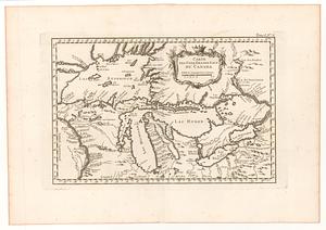
Carte des cinq grands lacs du Canada
12.
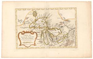
Carte des lac du Canada pour servir à l'histoire philosophique & politique des etablissemens et du commerce des européens dans...
13.
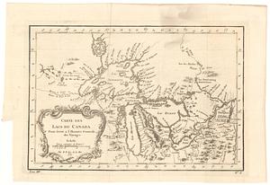
Carte des lacs du Canada pour servir a l'histoire generale des voyages
14.
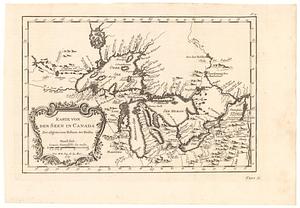
Karte von den seen in Canada zur allgemeinen historie der reisen
15.
La Louisiana, parte settentrionalle, scoperta sotto la protettione di Luigi XIV, Ré di Francia, etc
16.
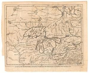
A map of the five great lakes with part of Pensilvania, New York, Canada and Hudson Bay territories &c.'
17.
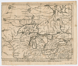
A Map of the five Great Lakes with part of Pensilvania, New York, Canada, and Hudsons Bay Territories &c
18.
Partie de l'Amérique septent? qui comprend la Nouvelle France ou le Canada
19.
Partie occidentale de la Nouvelle France ou du Canada : pour servir a l'intelligence des affaires et de l"etat present en Amerique
20.
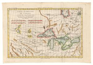
Partie occidentale du Canada, contenant les cinq grands lacs, avec les pays circonvoisins
‹ Prev
Next ›
1
2
3
4
5
…
19
20