Toggle navigation
LMEC Home
Exhibitions
Georeferencing
Tools for Teachers
Collections
My Favorites
Sign Up / Log In
Search
Search the map portal
Map Collection
Map Collection
Map Sets
Search
Search
Search for
Search In
All Fields
Creator
Title
Subject
Place
Search All Digital Collections
Advanced Search
8790 Results
My Search
Start Over
More Like
commonwealth:2514p150x
Remove constraint More Like: commonwealth:2514p150x
Filter your Search
Place
North and Central America
6,021
United States
4,921
Massachusetts
2,083
Europe
1,396
Suffolk (county)
1,045
Boston
1,018
Canada
467
Asia
438
more
Place
»
Topic
Boston (Mass.)--Maps
586
United States--Maps
282
Real property--Massachusetts--Boston--Maps
175
Massachusetts--Maps
162
Landowners--Massachusetts--Boston--Maps
133
North America--Maps--Early works to 1800
107
New England--Maps
102
New England--Maps--Early works to 1800
97
more
Topic
»
Date
Date range begin
–
Date range end
Current results range from
1482
to
2023
View distribution
Creator
United States. Hydrographic Office
595
O.H. Bailey & Co
148
Des Barres, Joseph F. W. (Joseph Frederick Wallet), 1722-1824
123
United States. Post Office Dept
120
Ptolemy, 2nd cent
100
Walling, Henry Francis, 1825-1888
94
Jefferys, Thomas, -1771
91
Geological Survey (U.S.)
86
more
Creator
»
Format
Maps/Atlases
8,730
Manuscripts
218
Prints
56
Books
36
Objects/Artifacts
10
Drawings/Illustrations
8
Posters
5
Georeferenced
Yes
875
No
7,915
Collection
Norman B. Leventhal Map & Education Center Collection
8,723
Boston and New England Maps
2,242
Urban Maps
2,023
Maritime Charts and Atlases
1,089
American Revolutionary War-Era Maps
678
Boston Redevelopment Authority Collection
87
Mapping Boston Collection
28
MacLean Collection Map Library
17
more
Collection
»
Available to use
No known restrictions
8,556
Creative Commons license
105
Search Constraints
Sort by relevance
relevance
title
date (asc)
date (desc)
Number of results to display per page
20 per page
10
per page
20
per page
50
per page
100
per page
View results as:
grid view
map view
Search Results
141.
Noua Anglia, Nouum Belgium, et Virginia
142.
Nouvelle Angleterre et Nouvel York
143.
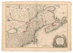
Partie de la Novvelle Angleterre contenant les villes, les bourgs, et le commerce des habitans
144.
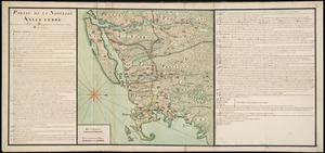
Partie septentrionale des possessions Angloise en Amerique : pour servire d'intelligence à la guerre présente entre les...
145.
Partie septentrionale des possessions angloise en Amerique
146.
Pas-kaart vande zee kusten inde boght van Niew Engeland : tusschen de staaten Hoek en C. de Sable
147.
Plan des jenigen treffen welches am 8. Sept 1755. zwischen dem Engl. Gen. Johnson, und dem Franz. Gen. Diesckau welcher dabey...
148.
Schauplatz des Kriegs zwischen Engelland und seinen Collonien in America
149.
The seat of war, in New England, by an American volunteer : with the marches of the several corps sent by the colonies, towards...
150.
The south part of New England as it planted this yeare, 1634
151.
The south part of New England, as it planted this yeare, 1639
152.
The 100th anniversary map of Abraham Lincoln's visit to Massachusetts, September 11-23, 1848
153.
1630 shoreline
154.
1879. Progress map of the U.S. Geographical Surveys west of the 100th Meridian : prepared under the direction of 1st Lieut....
155.
1903 Map of Salem and surrounding places
156.
19th annual convention of the National Association of Real Estate Boards : at Tulsa, June 7 to June 11 in 1926
157.
2005 significant U.S. hurricane strikes
158.
The 2100 project : an atlas for the Green New Deal
159.
227 Harzgerode
160.
305 Glatz
‹ Prev
Next ›
1
2
…
4
5
6
7
8
9
10
11
12
…
439
440