Toggle navigation
LMEC Home
Exhibitions
Georeferencing
Tools for Teachers
Collections
My Favorites
Sign Up / Log In
Search
Search the map portal
Map Collection
Map Collection
Map Sets
Search
Search
Search for
Search In
All Fields
Creator
Title
Subject
Place
Search All Digital Collections
Advanced Search
8720 Results
My Search
Start Over
More Like
commonwealth:2514p078d
Remove constraint More Like: commonwealth:2514p078d
Filter your Search
Place
North and Central America
5,927
United States
4,844
Massachusetts
2,079
Europe
1,396
Suffolk (county)
1,046
Boston
1,019
Canada
449
Asia
439
more
Place
»
Topic
Boston (Mass.)--Maps
586
United States--Maps
282
Real property--Massachusetts--Boston--Maps
175
Massachusetts--Maps
162
Landowners--Massachusetts--Boston--Maps
133
North America--Maps--Early works to 1800
104
New England--Maps
102
Europe--Maps
79
more
Topic
»
Date
Date range begin
–
Date range end
Current results range from
1482
to
2023
View distribution
Creator
United States. Hydrographic Office
595
O.H. Bailey & Co
148
Des Barres, Joseph F. W. (Joseph Frederick Wallet), 1722-1824
123
United States. Post Office Dept
120
Ptolemy, 2nd cent
100
Walling, Henry Francis, 1825-1888
94
Geological Survey (U.S.)
86
Jefferys, Thomas, -1771
86
more
Creator
»
Format
Maps/Atlases
8,660
Manuscripts
215
Prints
56
Books
36
Objects/Artifacts
10
Drawings/Illustrations
8
Posters
5
Georeferenced
Yes
869
No
7,851
Collection
Norman B. Leventhal Map & Education Center Collection
8,697
Boston and New England Maps
2,233
Urban Maps
2,023
Maritime Charts and Atlases
1,083
American Revolutionary War-Era Maps
629
Boston Redevelopment Authority Collection
87
Sidney R. Knafel Map Collection at Phillips Academy
10
MacLean Collection Map Library
6
more
Collection
»
Available to use
No known restrictions
8,552
Creative Commons license
57
Search Constraints
Sort by relevance
relevance
title
date (asc)
date (desc)
Number of results to display per page
20 per page
10
per page
20
per page
50
per page
100
per page
View results as:
grid view
map view
Search Results
2441.
General map of the island of Maui : as surveyed to March 1st 1880
2442.
A general map of the middle British colonies in America : viz. Virginia, Maryland, Delaware, Pensilvania, New-Jersey, New-York,...
2443.
A general map of the middle British colonies, in America : containing Virginia, Maryland, the Delaware counties, Pennsylvania...
2444.
A general map of the middle British colonies in America, viz. Virginia, Maryland, Delaware, Pensilvania, New-Jersey, New York,...
2445.
A general map of the northern British Colonies in America : which comprehends the province of Quebec, the government of...
2446.
A general map of the northern British colonies in America : which comprehends the province of Quebec, the government of...
2447.
A general map of the southern British colonies in America comprehending North and South Carolina, Georgia, East and West...
2448.
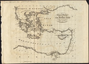
General outline of the Authors route as adapted to the second section of part the second of these travels
2449.
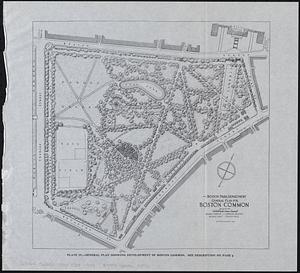
General plan for Boston Common
2450.
General plan for Columbus Park, Strandway, South Boston
2451.
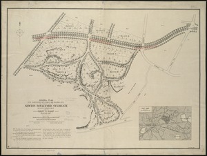
General plan for subdividing into roads and building lots, the property of the Newton Boulevard Syndicate, blocks 1, 2, 3, 4,...
2452.
General plan of Franklin Park
2453.
General plan of Mt. Hope cemetery showing surrounding streets and the general scheme of interior roads, paths, and arrangement...
2454.
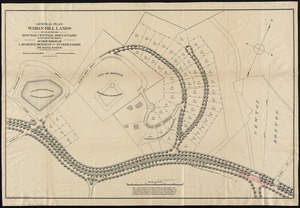
General plan Waban Hill lands on and near Newton Central Boulevard (eastern division) : subdivision of Lawrence, Bennett and...
2455.
General railway map engraved expressly for the Official guide of the railways and steam navigation lines of the United States,...
2456.
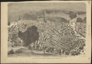
General unsicht von Boston and der Bogelschau mit Bezeichnung des abgebrannten Stadttheiles : = Bird's eye view of Boston,...
2457.
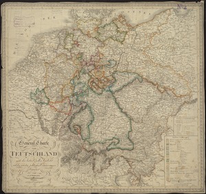
General-Charte von Teutschland nach den besten Quellen bearbeitet und den neuesten politischen Veraenderungen begrenzt
2458.
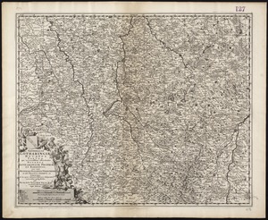
Generalis Lotharingiae Ducatus Tabula, qua accuratissime oftenduntur Ducatus Lotharingiae Propriae et Barrensis nec non...
2459.
Generalkarte von Nord America samt den Westindischen inseln
2460.
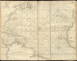
A generall chart of the western ocean
‹ Prev
Next ›
1
2
…
119
120
121
122
123
124
125
126
127
…
435
436