Toggle navigation
LMEC Home
Exhibitions
Georeferencing
Tools for Teachers
Collections
My Favorites
Sign Up / Log In
Search
Search the map portal
Map Collection
Map Collection
Map Sets
Search
Search
Search for
Search In
All Fields
Creator
Title
Subject
Place
Search All Digital Collections
Advanced Search
8923 Results
My Search
Start Over
More Like
commonwealth:1257c1959
Remove constraint More Like: commonwealth:1257c1959
Filter your Search
Place
North and Central America
6,154
United States
5,070
Massachusetts
2,138
Europe
1,396
Suffolk (county)
1,269
Boston
1,242
Canada
449
Asia
438
more
Place
»
Topic
Boston (Mass.)--Maps
753
United States--Maps
282
Real property--Massachusetts--Boston--Maps
254
City planning--Massachusetts--Boston--Maps
189
Landowners--Massachusetts--Boston--Maps
170
Massachusetts--Maps
166
New England--Maps
104
North America--Maps--Early works to 1800
103
more
Topic
»
Date
Date range begin
–
Date range end
Current results range from
1482
to
2023
View distribution
Creator
United States. Hydrographic Office
595
Boston Redevelopment Authority
192
O.H. Bailey & Co
148
Des Barres, Joseph F. W. (Joseph Frederick Wallet), 1722-1824
124
United States. Post Office Dept
120
Ptolemy, 2nd cent
100
Walling, Henry Francis, 1825-1888
94
Geological Survey (U.S.)
87
more
Creator
»
Format
Maps/Atlases
8,863
Manuscripts
215
Prints
56
Books
36
Objects/Artifacts
10
Drawings/Illustrations
8
Posters
5
Georeferenced
Yes
885
No
8,038
Collection
Norman B. Leventhal Map & Education Center Collection
8,725
Boston and New England Maps
2,393
Urban Maps
2,177
Maritime Charts and Atlases
1,083
American Revolutionary War-Era Maps
638
Boston Redevelopment Authority Collection
225
Massachusetts Real Estate Atlases
38
Mapping Boston Collection
20
more
Collection
»
Available to use
No known restrictions
8,700
Creative Commons license
70
Search Constraints
Sort by relevance
relevance
title
date (asc)
date (desc)
Number of results to display per page
20 per page
10
per page
20
per page
50
per page
100
per page
View results as:
grid view
map view
Search Results
741.
Plan of lots on Mount-Bowdoin in Dorchester
742.
Plan of real estate belonging to T.W. & J.H. Cox : situated in ward 16, Boston
743.
Plan of real estate in Charlestown belonging to Seth Barker & others : to be sold on the premises at public auction, June 26th,...
744.
Plan of sections of 1, 2 & 3, East Boston
745.
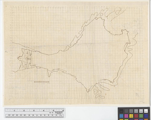
[Plan of the cove between Savin Hill and Commercial Point, Dorchester]
746.
Plat of lots in Boston (Dorchester Dist.) belonging to B.P. Cunningham
747.
Rugby : belonging to Wood, Harmon & Co
748.
Tax parcels that would have been underwater in 1630
749.
Hancock Woods : as of right plan
750.
Hancock Woods EGA
751.
1975 general land use plan
752.
An accurate plan of the town of Boston and its vicinity : exhibiting a ground plan of all the streets, lanes, alleys, wharves,...
753.
Atlas of Massachusetts
754.
Boston
755.
Boston
756.
Boston
757.
Boston and adjacent cities
758.
Boston and its environs
759.
Boston and surroundings
760.
Boston bikemap : toward intelligent commuting
‹ Prev
Next ›
1
2
…
34
35
36
37
38
39
40
41
42
…
446
447


![[Plan of the cove between Savin Hill and Commercial Point, Dorchester]](https://bpldcassets.blob.core.windows.net/derivatives/images/commonwealth:js956k66d/image_thumbnail_300.jpg)