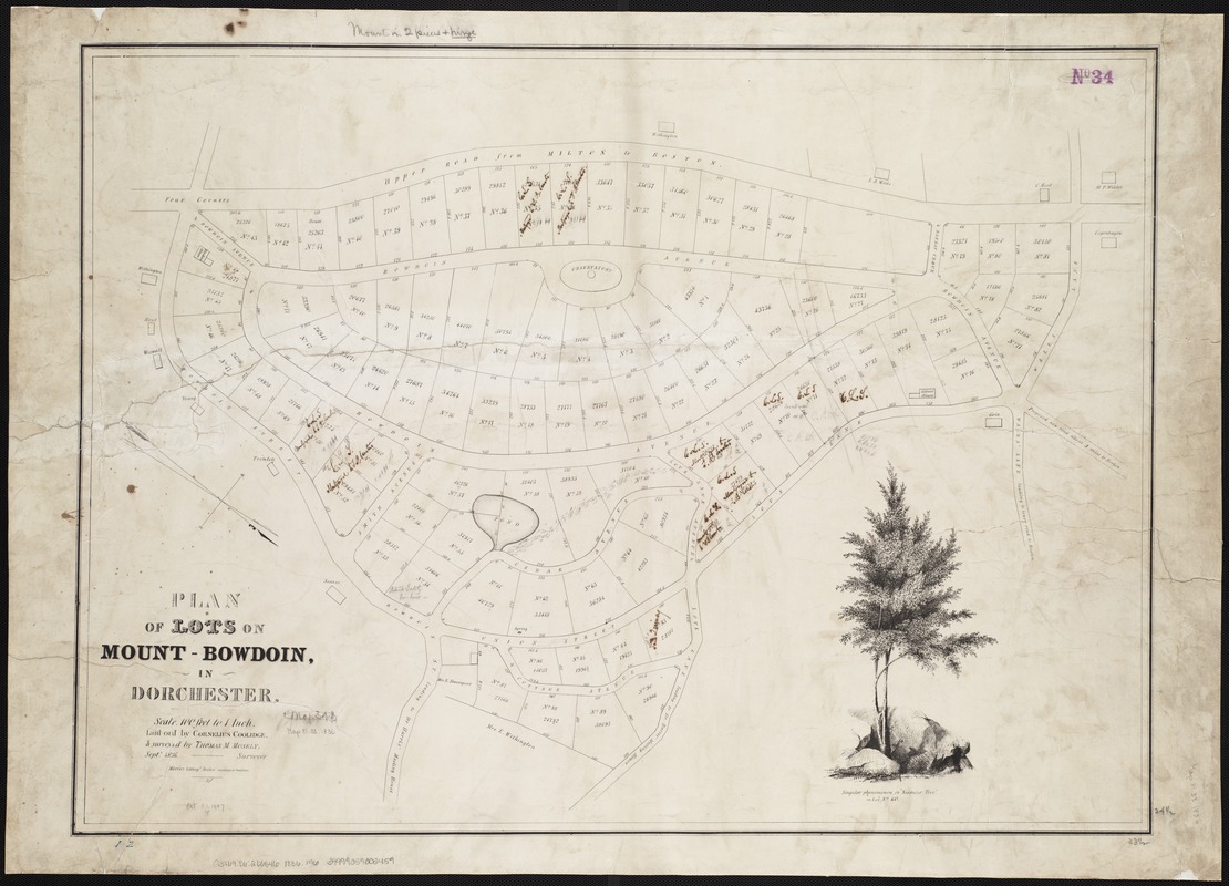
Plan of lots on Mount-Bowdoin in Dorchester
Item Information
- Title:
- Plan of lots on Mount-Bowdoin in Dorchester
- Creator:
- Mosely, Thomas M.
- Name on Item:
-
laid out by Cornelius Coolidge ; surveyed by Thomas M. Mosely.
- Date:
-
[1836]
- Format:
-
Maps/Atlases
- Location:
-
Boston Public Library
Norman B. Leventhal Map & Education Center - Collection (local):
-
Norman B. Leventhal Map & Education Center Collection
- Subjects:
-
Real property--Massachusetts--Boston--Maps
Land tenure--Massachusetts--Boston--Maps
Dorchester (Boston, Mass.)--Maps
Dorchester (Boston, Mass.)
- Places:
-
MassachusettsSuffolk (county)BostonDorchester
- Extent:
- 1 map ; 63 x 86 cm.
- Terms of Use:
-
No known copyright restrictions.
No known restrictions on use.
- Publisher:
-
Boston, Mass :
Moore's Lithogy
- Scale:
-
Scale [1:1,200].
- Language:
-
English
- Notes:
-
Oriented with north toward the lower right.
Cadastral map showing lot numbers, dimensions, areas, and some names of adjacent property owners.
"Septr. 1836."
Includes view of Siamese tree on lot no. 60.
- Notes (date):
-
This date is inferred.
- Identifier:
-
06_01_003870
- Call #:
-
G3764.B6:2D6 1836 .M6
- Barcode:
-
39999059002459

![[Plan of house lots for sale on Savin Hill Avenue, Dorchester, Mass.]](https://bpldcassets.blob.core.windows.net/derivatives/images/commonwealth:9s161f68b/image_thumbnail_300.jpg)


