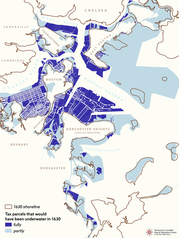
Tax parcels that would have been underwater in 1630
Item Information
- Title:
- Tax parcels that would have been underwater in 1630
- Cartographer:
- Boston Public Library. Norman B. Leventhal Map and Education Center
- Name on Item:
-
Leventhal Map & Education Center at the Boston Public Library
- Date:
-
2021
- Format:
-
Maps/Atlases
- Location:
-
Boston Public Library
Norman B. Leventhal Map & Education Center - Collection (local):
-
Norman B. Leventhal Map & Education Center Collection
- Subjects:
-
Fills (Earthwork)--Massachusetts--Boston--Maps
Real property--Massachusetts--Boston--Maps
Boston (Mass.)--Historical geography--Maps
- Places:
-
MassachusettsSuffolk (county)Boston
- Extent:
- 1 map : color
- Terms of Use:
-
No known copyright restrictions.
No known restrictions on use.
- Language:
-
English
- Notes:
-
Shows 1630 shoreline and indicates current tax parcels that would have been fully or partly underwater in 1630.
- Identifier:
-
shoreline-render


