Toggle navigation
LMEC Home
Exhibitions
Georeferencing
Tools for Teachers
Collections
My Favorites
Sign Up / Log In
Search
Search the map portal
Map Collection
Map Collection
Map Sets
Search
Search
Search for
Search In
All Fields
Creator
Title
Subject
Place
Search All Digital Collections
Advanced Search
8700 Results
My Search
Start Over
More Like
commonwealth:0z709728b
Remove constraint More Like: commonwealth:0z709728b
Filter your Search
Place
North and Central America
5,927
United States
4,845
Massachusetts
2,079
Europe
1,396
Suffolk (county)
1,047
Boston
1,020
Canada
449
Asia
437
more
Place
»
Topic
Boston (Mass.)--Maps
586
United States--Maps
282
Real property--Massachusetts--Boston--Maps
176
Massachusetts--Maps
162
Landowners--Massachusetts--Boston--Maps
133
North America--Maps--Early works to 1800
103
New England--Maps
102
Europe--Maps
79
more
Topic
»
Date
Date range begin
–
Date range end
Current results range from
1482
to
2023
View distribution
Creator
United States. Hydrographic Office
595
O.H. Bailey & Co
148
Des Barres, Joseph F. W. (Joseph Frederick Wallet), 1722-1824
123
United States. Post Office Dept
120
Ptolemy, 2nd cent
100
Walling, Henry Francis, 1825-1888
94
Geological Survey (U.S.)
86
Jefferys, Thomas, -1771
85
more
Creator
»
Format
Maps/Atlases
8,640
Manuscripts
215
Prints
56
Books
36
Objects/Artifacts
10
Drawings/Illustrations
8
Posters
5
Georeferenced
Yes
869
No
7,831
Collection
Norman B. Leventhal Map & Education Center Collection
8,694
Boston and New England Maps
2,234
Urban Maps
2,024
Maritime Charts and Atlases
1,083
American Revolutionary War-Era Maps
616
Boston Redevelopment Authority Collection
88
MacLean Collection Map Library
5
Available to use
No known restrictions
8,553
Creative Commons license
47
Search Constraints
Sort by relevance
relevance
title
date (asc)
date (desc)
Number of results to display per page
20 per page
10
per page
20
per page
50
per page
100
per page
View results as:
grid view
map view
Search Results
21.
China's situation in the world
22.
Clothing recommendations for travel in China
23.
Commercial map of China : showing treaty ports, ports of foreign control, railways, telegraphs, waterways, etc., 1899
24.
Map of China : compiled from original surveys & sketches
25.
Map of China, Burma, Siam, Annam &c
26.
Map of north eastern China
27.
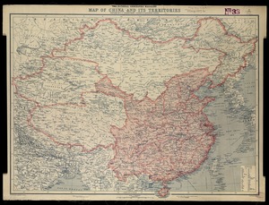
National Geographic Magazine map of China and its territories
28.
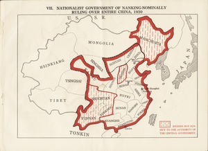
Nationalist government of Nanking - nominally ruling over entire China, 1930
29.
A new map of the East Indies and China from the best authorities
30.
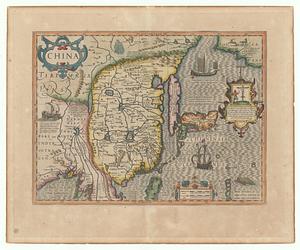
[Universal map of China]
31.
W. & A.K. Johnston's map to illustrate the Chinese question
32.
Topographic map, Washington Park project r-24
33.
China
34.
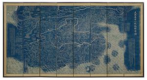
Daqing wannian yitong dili quantu
35.
Dongguk yojido
36.
Haejwa do
37.
Yeojido
38.
The 100th anniversary map of Abraham Lincoln's visit to Massachusetts, September 11-23, 1848
39.
1630 shoreline
40.
1879. Progress map of the U.S. Geographical Surveys west of the 100th Meridian : prepared under the direction of 1st Lieut....
‹ Prev
Next ›
1
2
3
4
5
6
…
434
435


![[Universal map of China]](https://bpldcassets.blob.core.windows.net/derivatives/images/commonwealth:qb98n8079/image_thumbnail_300.jpg)