W. & A.K. Johnston's map to illustrate the Chinese question
Item Information
- Title:
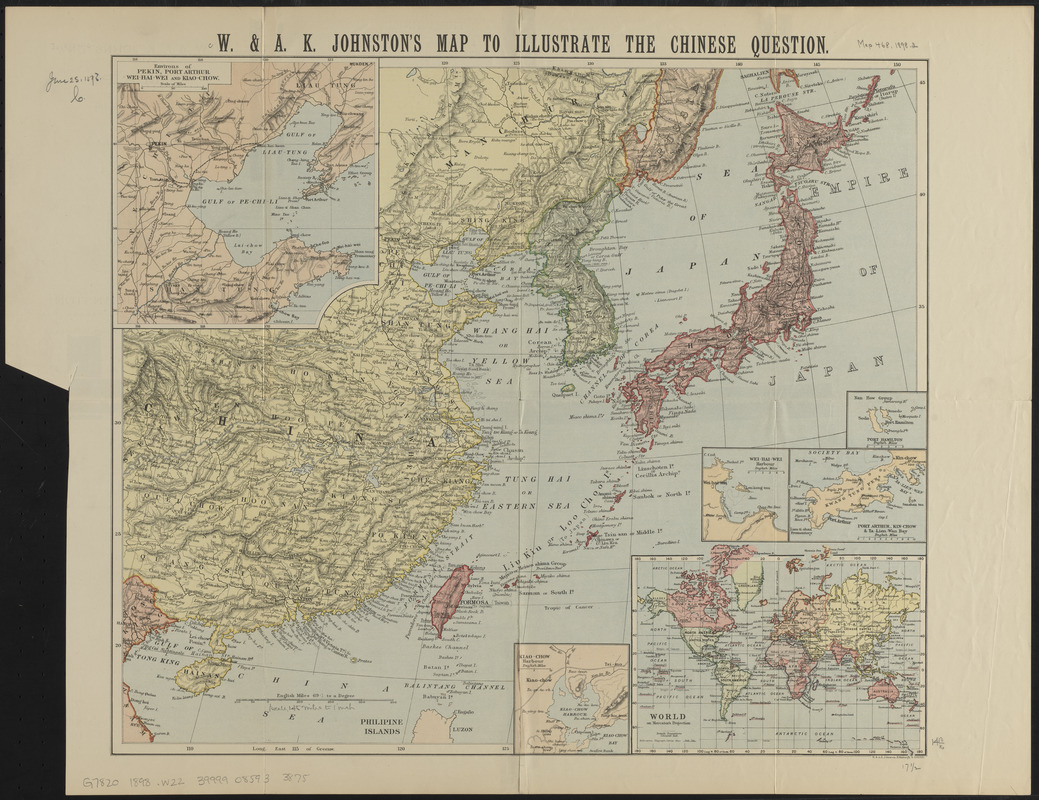
- W. & A.K. Johnston's map to illustrate the Chinese question
- Title (alt.):
-
Map to illustrate the Chinese question
- Publisher:
- W. & A.K. Johnston Limited
- Date:
-
1898
- Format:
-
Maps/Atlases
- Location:
-
Boston Public Library
Norman B. Leventhal Map & Education Center - Collection (local):
-
Norman B. Leventhal Map & Education Center Collection
- Subjects:
-
China--Maps
- Places:
-
China
- Extent:
- 1 map : color ; 39 x 45 cm, folded to 22 x 15 cm
- Terms of Use:
-
No known copyright restrictions.
No known restrictions on use.
- Publisher:
-
Edinburgh :
W. & A.K. Johnston
- Scale:
-
Scale approximately 1:9,200,000
- Language:
-
English
- Notes:
-
Relief shown by hachures.
Insets: Port Hamilton -- Wei-Hai-Wei Harbour -- Port Arthur, Kin-Chow & Ta-Lein-Wan Bay -- World on Mercator's projection -- Kiao-Chow Harbour -- Environs of Pekin, Port Arthur, Wei-Hai Wei and Kiao-Chow.
Text on verso.
- Identifier:
-
06_01_015244
- Call #:
-
G7820 1898 .W22
- Barcode:
-
39999085933875