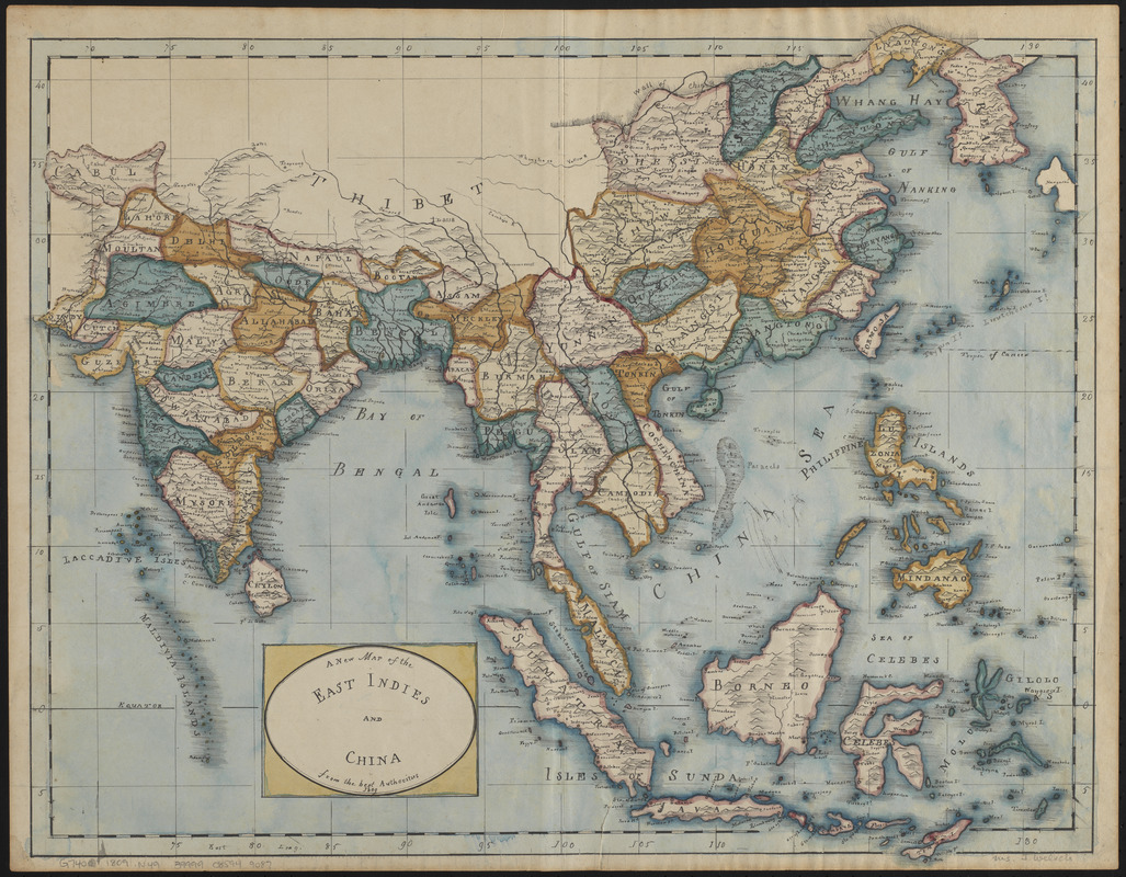
A new map of the East Indies and China from the best authorities
Item Information
- Title:
- A new map of the East Indies and China from the best authorities
- Date:
-
1809
- Format:
-
Maps/Atlases
Manuscripts
- Location:
-
Boston Public Library
Norman B. Leventhal Map & Education Center - Collection (local):
-
Norman B. Leventhal Map & Education Center Collection
- Subjects:
-
East Indies--Maps
China--Maps
Southeast Asia--Maps
South Asia--Maps
- Places:
-
East Indies (area)
China
India (subcontinent)
Southeast Asia (area)
- Extent:
- 1 manuscript map : hand color ; 41 x 51 cm
- Terms of Use:
-
No known copyright restrictions.
No known restrictions on use.
- Scale:
-
Scale approximately 1:14,300,000
- Language:
-
English
- Notes:
-
Covers South Asia, Southeast Asia, and southeastern China.
Manuscript map in pen and ink and watercolor, likely drawn by a schoolgirl.
Relief shown pictorially.
Manuscript in pencil in lower right: Ms. J. Wel[ich?].
Manuscript in ink in upper right on verso: 23.
Gift of Michael Ellman, 2018.
- Identifier:
-
06_01_016636
- Call #:
-
G7400 1809 .N49
- Barcode:
-
39999085949087